Back مقاطعة وونغ تاي سين Arabic Wong Tai Sin CEB Wong Tai Sin District German Distrito de Wong Tai Sin Spanish Wong Tai Sin barrutia Basque منطقه وانگ تای سین Persian Wong Tai Sin (district) French Vòng-thai-siên-khî HAK וונג טאי סין HE Vóngtájszín Hungarian
This article needs additional citations for verification. (October 2016) |
Wong Tai Sin
黃大仙區 | |
|---|---|
| Wong Tai Sin District | |
 Day view of San Po Kong in the Wong Tai Sin District | |
 | |
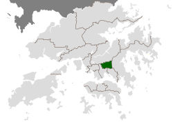
 Location of Wong Tai Sin within Hong Kong | |
| Coordinates: 22°20′01″N 114°11′49″E / 22.33353°N 114.19686°E | |
| Country | China |
| SAR | Hong Kong |
| Constituencies | 25 |
| Government | |
| • District Council Chairman | vacant |
| • District Council Vice-Chairman | vacant |
| • District Officer | William Shiu |
| Area | |
• Total | 9.36 km2 (3.61 sq mi) |
| Population (2011[2]) | |
• Total | 420,183 |
| • Density | 45,000/km2 (120,000/sq mi) |
| Time zone | UTC+8 (Hong Kong Time) |
| Largest neighbourhood by population | Tsz Wan Shan (80,935 – 2016 est)[3] |
| Location of district office and district council | 138 Lung Cheung Road, Wong Tai Sin |
| Website | Wong Tai Sin District Council |
| Wong Tai Sin District | |||||||||||||||
|---|---|---|---|---|---|---|---|---|---|---|---|---|---|---|---|
| Traditional Chinese | 黃大仙區 | ||||||||||||||
| Simplified Chinese | 黄大仙区 | ||||||||||||||
| Cantonese Yale | Wòhng daaih sīn kēui | ||||||||||||||
| Literal meaning | big yellow immortal district | ||||||||||||||
| |||||||||||||||
Wong Tai Sin District is one of the 18 districts of Hong Kong. It is the only landlocked district in Hong Kong. It is located in Kowloon, and is the northernmost district in Kowloon. It borders the districts of Kwun Tong to its southeast, Kowloon City to its southwest, Sai Kung to its east, and Sha Tin to its north.
- ^ Eunice Mei Feng Seng (2020). Resistant City: Histories, Maps and the Architecture of Development. doi:10.1142/11394. ISBN 9789811211706. OCLC 1195954303.
- ^ "2011 Population Census: Summary Results" (in English and Chinese). Census and Statistics Department, Hong Kong Government. 2011. Retrieved 11 June 2012.[needs update]
- ^ Summary of Provisional Recommendations for Wong Tai Sin District (PDF), Hong Kong Government, July 2019, retrieved 15 April 2020