Native name: Yama; Iama Nickname: Turtle-backed Island | |
|---|---|
 Landsat image of Yam Island | |
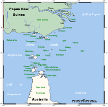
 A map of the Torres Strait Islands showing Yam Island in the central waters of Torres Strait | |
| Geography | |
| Location | Tancred Passage, Northern Australia |
| Coordinates | 9°54′05″S 142°46′30″E / 9.9014°S 142.7750°E |
| Archipelago | Bourke Isles group, Torres Strait Islands |
| Adjacent to | Torres Strait |
| Total islands | 1 |
| Area | 2 km2 (0.77 sq mi) |
| Administration | |
Australia | |
| State | Queensland |
| Local government area | Torres Strait Island Region |
| Demographics | |
| Ethnic groups | Torres Strait Islanders |
| Yam Island Queensland | |||||||||||||||
|---|---|---|---|---|---|---|---|---|---|---|---|---|---|---|---|
| Coordinates | 9°54′04″S 142°46′27″E / 9.9011°S 142.7741°E | ||||||||||||||
| Population | 275 (SAL 2021)[1][2] | ||||||||||||||
| Postcode(s) | 4875 | ||||||||||||||
| Area | 1.9 km2 (0.7 sq mi) | ||||||||||||||
| Time zone | AEST (UTC+10:00) | ||||||||||||||
| LGA(s) | Torres Strait Island Region | ||||||||||||||
| State electorate(s) | Cook | ||||||||||||||
| Federal division(s) | Leichhardt | ||||||||||||||
| |||||||||||||||
Yam Island, called Yama or Iama in the Kulkalgau Ya language or Turtle-backed Island in English, is an island of the Bourke Isles group of the Torres Strait Islands, located in the Tancred Passage of the Torres Strait in Queensland, Australia.[3] The island is situated approximately 100 kilometres (62 mi) northeast of Thursday Island and measures about 2 square kilometres (0.77 sq mi).[4] The island is an official locality known as Iama Island within the local government area of Torres Strait Island Region.[5] The town, also called Yam Island, is located on the north-west coast of the island.[6] In the 2021 census, Iama Island had a population of 275 people.[7]
Its indigenous language is Kulkalgau Ya, a dialect of the Western-Central Torres Strait language, Kalaw Lagaw Ya.
- ^ Australian Bureau of Statistics (28 June 2022). "Iama Island (suburb and locality)". Australian Census 2021 QuickStats. Retrieved 28 June 2022.
- ^ Australian Bureau of Statistics (28 June 2022). "Yam Island (suburb and locality)". Australian Census 2021.
- ^ "Yam Island – island in the Torres State Island Region (entry 38377)". Queensland Place Names. Queensland Government. Retrieved 14 July 2023.
- ^ "Iama Island – locality in Torres Strait Island Region (entry 46708)". Queensland Place Names. Queensland Government. Retrieved 19 September 2020.
- ^ "Iama Island – locality in the Torres Strait Island Region (entry 46708)". Queensland Place Names. Queensland Government. Retrieved 14 July 2023.
- ^ "Yam Island – population centre in the Torres Strait Island Region (entry 44493)". Queensland Place Names. Queensland Government. Retrieved 14 July 2023.
- ^ Cite error: The named reference
Census2021was invoked but never defined (see the help page).

