Back Yorkshire Dales National Park CEB Յորքշիր Դեյլս Armenian Taman Nasional Yorkshire Dales ID Yorkshire Dales-þjóðgarðurinn Icelandic Parco nazionale delle Yorkshire Dales Italian Park Kenedhlek Nansow Konteth Evrek KW Nationaal park Yorkshire Dales Dutch Yorkshire Dales mama llaqta parki Quechua Йоркшир-Дейлс Russian Yorkshire Dales Serbo-Croatian
| Yorkshire Dales National Park | |
|---|---|
IUCN category V (protected landscape/seascape) | |
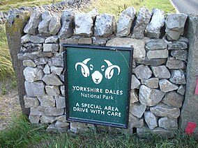
 National park entrance sign, near Skipton | |
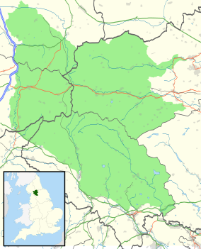
 Location and extent of the Yorkshire Dales National Park, as of August 2016 | |
| Location | North Yorkshire, Westmorland & Lancashire, England |
| Coordinates | 54°15′N 2°13′W / 54.250°N 2.217°W |
| Area | 2,178 km2 (841 sq mi) |
| Max. elevation | Whernside 736 m (2,415 ft) |
| Designation | National Park |
| Established | 1954 |
| UK National Parks |
|---|
| Parentheses denotes the year. An area with ‡ has similar status to a UK National Park. Areas marked † are proposed. |


The Yorkshire Dales National Park is a 2,178 km2 (841 sq mi) national park in England which covers most of the Yorkshire Dales, the Howgill Fells, and the Orton Fells. The Nidderdale area of the Yorkshire Dales is not within the national park, and has instead been designated a national landscape. Most of the park is within North Yorkshire, with a sizeable area in Cumbria and a small part in Lancashire. The park was designated in 1954, and extended in 2016. More than 95% of the land in the park is privately owned; there are over 1,000 farms in this area.[1]
In 2020, the national park was named an International Dark Sky Reserve. This means that the area has "low levels of light pollution with good conditions for astronomy".[2]
As of 2017,[update] some 23,500 residents live within the park boundary; a 2018 report estimated that the park attracted more than four million visitors per year.[3] The economy consists primarily of tourism and agriculture.[4]
- ^ 4.2 Land ownership and population
- ^ "Yorkshire Dales and North York Moors made Dark Sky Reserves". BBC News. 8 December 2020. Retrieved 27 February 2021.
- ^ Introduction to the Yorkshire Dales National Park, Section 2.1
- ^ 2.4 Population and economy