Back يوكون (أوكلاهوما) Arabic يوكون (كنيديان, اوكلاهوما) ARZ ایوکان، اوکلاهوما AZB Yukon (Oklahoma) Catalan Юкон (Оклагома) CE Yukon (lungsod sa Tinipong Bansa, Oklahoma) CEB Yukon (Oklahoma) German Yukon (Oklahoma) Spanish Yukon (Oklahoma) Basque ایوکان (اکلاهما) Persian
Yukon, Oklahoma | |
|---|---|
 Yukon's Best Flour mill, located on U.S. Route 66 | |
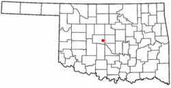
 Location of Yukon, Oklahoma | |
| Coordinates: 35°31′12″N 97°45′50″W / 35.52000°N 97.76389°W | |
| Country | United States |
| State | Oklahoma |
| County | Canadian |
| Government | |
| • Type | Council-Manager Government |
| • Mayor | Brian Pillmore (as of 2024)[1] |
| • Vice Mayor | Jeff Wootton (as of 2024)[1] |
| Area | |
• Total | 26.60 sq mi (68.89 km2) |
| • Land | 26.54 sq mi (68.74 km2) |
| • Water | 0.06 sq mi (0.15 km2) |
| Elevation | 1,273 ft (388 m) |
| Population (2020) | |
• Total | 23,630 |
| • Density | 890.35/sq mi (343.76/km2) |
| Time zone | UTC−6 (Central (CST)) |
| • Summer (DST) | UTC−5 (CDT) |
| ZIP codes | 73085, 73099 |
| Area code | 405 |
| FIPS code | 40-82950 [4] |
| GNIS feature ID | 2412327[3] |
| Website | www |
Yukon is a city in eastern Canadian County, Oklahoma, United States. The population was 23,630 at the 2020 census. Founded in the 1890s, the town was named in reference to a gold rush in Yukon Territory, Canada, at the time. Historically, Yukon served as an urban center for area farmers and the site of a milling operation. Currently, it is primarily a residential community for people who work in the Oklahoma City Metropolitan Area.
- ^ a b City of Yukon. "City Council". Retrieved July 31, 2024.
- ^ "ArcGIS REST Services Directory". United States Census Bureau. Retrieved September 20, 2022.
- ^ a b U.S. Geological Survey Geographic Names Information System: Yukon, Oklahoma
- ^ "U.S. Census website". United States Census Bureau. Retrieved January 31, 2008.
- ^ Cite error: The named reference
Yukon Oklahomawas invoked but never defined (see the help page).