Back Southend-on-Sea Afrikaans Southend-on-Sea AN ساوثند أون سي Arabic ساوثند اون سى ARZ Southend-on-Sea AST Sautend-on-Si Azerbaijani ساوتند-آن-سی AZB Саўтэнд-он-Сі Byelorussian Southend-on-Sea Catalan Southend-on-Sea (kapital sa kondado) CEB
| Southend-on-Sea | ||
|---|---|---|
| Villa | ||
 Vista aérea de Southend-on-Sea
| ||
 Escudo | ||
|
Lema: Per Mare Per Ecclesiam (latín: Por la mar, por la iglesia) | ||
|
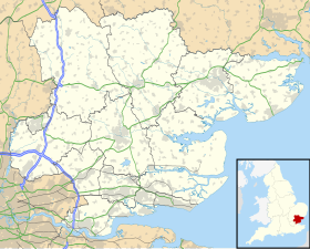
Localización de Southend-on-Sea en Essex | ||
| Coordenadas | 51°32′16″N 0°42′50″E / 51.53789, 0.71377 | |
| Entidad | Villa | |
| • País |
| |
| • Nación |
| |
| • Región | Este | |
| • Condado |
| |
| • Autoridad | Southend | |
| Superficie | ||
| • Total | 41.76 km² | |
| Población | Puesto 101.º | |
| • Total | 177,931 hab. | |
| • Densidad | 4,261 hab./km² | |
| Huso horario | UTC±00:00 | |
| • en verano | BST (UTC+1) | |
| Código postal | SS1, SS2, SS22, SS3 y SS99 | |
| Sitio web oficial | ||
Southend-on-Sea (ⓘ) es una autoridad unitaria y ciudad en el condado ceremonial de Essex, Inglaterra.[1][2] Distrito con categoría de municipio y comprende las poblaciones de Chalkwell, Eastwood, Leigh-on-Sea, North Shoebury, Prittlewell, Shoeburyness, Southchurch, Thorpe Bay y Westcliff-on-Sea. Está situado en la zona del Thames Gateway, del lado norte del estuario del Támesis, 64 km al este del centro de Londres. Está rodeado por el norte por Rochford y por el oeste por Castle Point. En Southend se encuentra el muelle más largo del mundo, conocido como Southend Pier.[3] Por población, es la 36.ª ciudad del Reino Unido, con 164.300 habitantes censados.
- ↑ Office for National Statistics (2009). «United Kingdom: Counties and Unitary Authorities» (en inglés). Consultado el 24 de febrero de 2013.
- ↑ Office for National Statistics. «Counties, Non-metropolitan Districts and Unitary Authorities» (en inglés). Consultado el 24 de febrero de 2013.
- ↑ David Else, ed. (2009). England. Lonely Planet travel guide (5ª edición). Lonely Planet. p. 445. ISBN 1741045908.
