Back ويتلاند (وايومنغ) Arabic ویتلاند، ویومینق AZB Wheatland (Wyoming) Catalan Витленд CE Wheatland (kapital sa kondado) CEB Wheatland, Wyoming Welsh Wheatland (Wyoming) German Wheatland, Wyoming English Wheatland (Wyoming) Spanish Wheatland (Wyoming) Basque
| Wheatland | ||||

| ||||
| Administration | ||||
|---|---|---|---|---|
| Pays | ||||
| État | ||||
| Comté | Platte | |||
| Type de localité | Town | |||
| Code ZIP | 82201 | |||
| Code FIPS | 56-83040 | |||
| GNIS | 1609173 | |||
| Indicatif(s) téléphonique(s) local (locaux) | 307 | |||
| Démographie | ||||
| Population | 3 627 hab. (2010) | |||
| Densité | 342 hab./km2 | |||
| Géographie | ||||
| Coordonnées | 42° 03′ 14″ nord, 104° 57′ 34″ ouest | |||
| Altitude | 1 448 m |
|||
| Superficie | 1 062 ha = 10,62 km2 | |||
| · dont terre | 10,62 km2 (100 %) | |||
| · dont eau | 0 km2 (−0 %) | |||
| Fuseau horaire | MST (UTC-7) | |||
| Localisation | ||||
 Carte du comté de Platte. | ||||
| Géolocalisation sur la carte : États-Unis
Géolocalisation sur la carte : États-Unis
Géolocalisation sur la carte : Wyoming
| ||||
| Liens | ||||
| Site web | http://www.wheatlandwy.com | |||
| modifier |
||||
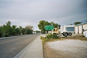
La ville américaine de Wheatland est le siège du comté de Platte, dans l’État du Wyoming. Lors du recensement de 2010, sa population s’élevait à 3 627 habitants.


