Back Зиватанехо (Зиватанехо де Азуета) CE Ixtapa-Zihuatanejo CEB Zihuatanejo Danish Zihuatanejo German Zihuatanejo English Zihuatanejo Spanish خوزه ازوتا، گوئررو Persian Zihuatanejo Hungarian Zihuatanejo ID Zihuatanejo Italian
| Zihuatanejo | |
 Héraldique |
|
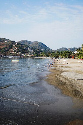
 Plage principale avec les quais en arrière-plan | |
| Administration | |
|---|---|
| Pays | |
| État | Guerrero |
| Maire | Alejandro Bravo Abarca |
| Code postal | 40880 |
| Fuseau horaire | UTC -6 |
| Indicatif | 755 |
| Démographie | |
| Gentilé | (es) Azuentense |
| Population | 62 376 hab. (2005) |
| Densité | 32 hab./km2 |
| Population de l'agglomération | 104 609 hab. |
| Géographie | |
| Coordonnées | 17° 23′ 02″ nord, 101° 19′ 49″ ouest |
| Altitude | 20 m |
| Superficie | 192 100 ha = 1 921 km2 |
| Divers | |
| Fondation | années 1520 |
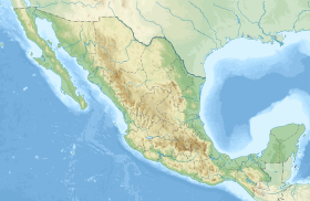
| Localisation | |
| Liens | |
| Site web | www.ixtapa-zihuatanejo.gob.mx |
| modifier |
|
Zihuatanejo est une ville mexicaine de l'État de Guerrero, chef-lieu de la municipalité de Zihuatanejo de Azueta.
C'est la quatrième plus grande ville du Guerrero (62 400 habitants en 2005). La municipalité comptait 126 000 habitants en 2020.


