Back Gaborone Afrikaans ጋበሮኔ Amharic Gaborone AN غابورون Arabic جابورون ARZ Gaborone AST Gaborone AVK Qaborone Azerbaijani قابۇرۇن AZB Габороне Bashkir
| Year dem found am | 1965 |
|---|---|
| Native label | Gaborone, Gaborone, Gaborone, Gaborone |
| Dem name after | Kgosi Gaborone |
| Demonym | gaboronais, gaboronaise, Gaberonano, Gaboronais, Gaboronaise |
| Country | Botswana |
| Capital of | Botswana, Bechuanaland Protectorate |
| Edey de administrative territorial entity insyd | South-East District |
| Located in time zone | Central Africa Time, UTC+02:00 |
| Coordinate location | 24°39′25″S 25°54′31″E |
| Twinned administrative body | Burbank, Zhejiang, Västerås Municipality, Sorong, Windhoek |
| Dema official website | http://www.gov.bw/en/Ministries--Authorities/Local-Authorities/Gaborone-City-Council |
| Local dialing code | 00267 |
| Category for maps or plans | Category:Maps of Gaborone |

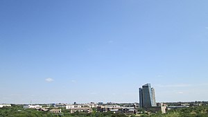
Gaborone be de capital den largest city of Botswana plus population of 246,325 base for de 2022 census,[1] about 10% of de total population of Botswana.[2] Ein agglomeration be home to 421,907 inhabitants at de 2011 census.
Gaborone dey situate between Kgale Hill den Oodi Hill, near de confluence for de Notwane River den Segoditshane River for de south-eastern corner for Botswana, 15 kilometres (9.3 mi) from de South African border.[3] Sir Seretse Khama International Airport wey dey serve de city. Ebe administrative district for ein own right, but ebe de capital for de surrounding South-East District.[4] Locals often dey refer de city as GC anaa Motse-Mshate.[5]
Den name de city of Gaborone after Chief Gaborone of de Tlokwa tribe, wey na once he control near nearby land.[6] Secof e no get tribal affiliation wey na e dey close to fresh water, dem plan de city make ebe de capital for de mid-1960s wen na de Bechuanaland Protectorate cam turn independent nation.[6] De centre of de city be long strip of commercial businesses, dem call am "Main Mall" plus semicircle-shaped area of government offices wey dey ein east. Na Gaborone once be one of de fastest-growing cities for de world insyd, wey dis create problems plus housing den illegal settlements. De city san so deal plus conflicts wey dey spill cam de country insyd from Zimbabwe den South Africa during de 1980s.
Gaborone be de economic capital den de government capital; ebe headquarters to chaw companies den de Botswana Stock Exchange. Gaborone san so be home give de Southern African Development Community (SADC), regional economic community dem establish for 1980 insyd.[7] Dem dey speak chaw languages for der, Setswana (Tswana) be de main tongue. Dem san so dey speak English, Kalanga, den Kgalagadi.
- ↑ "Statistics Bostwana - Census 2022 - Population of cities, towns and villages" (PDF).
- ↑ Central Statistics Office (January 2009). "Botswana Demographic Survey 2006" (PDF). Gaborone, Botswana. Archived from the original (PDF) on 23 September 2016. Retrieved 3 July 2010.
- ↑ Seth, Willie (2008). "Major urban centres". Botswana and Its People. Godfrey Mwakikagile. pp. 44–46. ISBN 978-0-9814258-7-0. Retrieved 4 August 2009.
- ↑ Laws of Botswana Archived 23 July 2011 at the Wayback Machine, Ministry of Local Government Archived 18 July 2009 at the Wayback Machine
- ↑ Njeru, Purity (2009). "History of Gaborone". Nairobi, Kenya: The African Executive. Archived from the original on 7 July 2011. Retrieved 4 August 2009.
- ↑ 6.0 6.1 "Map - Gaborone - MAP[N]ALL.COM". 174.127.109.64. Retrieved 30 May 2020.
- ↑ "Southern African Development Community :: About SADC". www.sadc.int. Archived from the original on 12 March 2018. Retrieved 28 April 2018.
