Back لوبارا Arabic لوپارا AZB Лупара (Італія) Byelorussian Лупара (Италия) Bulgarian Lupara Breton Лупара (Итали) CE Lupara (munisipyo) CEB Lupara (Molise) German Lupara, Molise English Lupara Esperanto
| Lupara comune tagliàne | ||
|---|---|---|
 | ||
| ||
| State | ||
| Reggione | ||
| Provinge | ||
| Coordinate | 41°46′00″N 14°44′00″E | |
| Altitudine | 505 m s.l.m. | |
| Superficie | 25,66 km² | |
| Crestiàne | 590 (2008 (Dati Istat)) | |
| Denzetà | 23 cr./km² | |
| Comune 'nzeccate | Casacalenda, Castelbottaccio, Civitacampomarano, Guardialfiera, Morrone del Sannio | |
| CAP | 86030 | |
| Prefisse | 0874 | |
| Codece ISTAT | 070034 | |
| Cod. catastale | E748 | |
| Patrone | San Nicola | |
| Sciurne festive | 6 dicembre | |
| Site istituzionale | ||
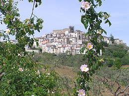
Lupara éte 'nu comune tagliáne de 651 crestiáne.

