Back منطقة برويت Arabic খেত প্রাৱেত BPY Prawet CEB Prawet German Prawet district English Prawet Estonian Prawet French Prawet Italian プラウェート区 Japanese 쁘라웻 Korean
The "Scots" that wis uised in this airticle wis written bi a body that haesna a guid grip on the leid. Please mak this airticle mair better gin ye can. |
Prawet ประเวศ | |
|---|---|
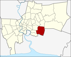
 Khet location in Bangkok | |
| Coordinates: 13°43′1″N 100°41′40″E / 13.71694°N 100.69444°ECoordinates: 13°43′1″N 100°41′40″E / 13.71694°N 100.69444°E | |
| Kintra | |
| Province | Bangkok |
| Seat | Prawet |
| Khwaeng | 3 |
| Khet established | 9 November 1989 |
| Area | |
| • Total | 52.5 km2 (20.3 sq mi) |
| Population (2000) | |
| • Total | 134,189 |
| • Density | 2556/km2 (6,620/sq mi) |
| Time zone | UTC+7 (THA) |
| Postal code | 10250 Dokmai, Mu 2-10 of Nong Bon: 10260 |
| Geocode | 1032 |
Prawet (Thai: ประเวศ; IPA: [prà.wêːt]) is ane o the 50 destricts o Bangkok, Thailand, locatiit in the sootheast o the toun. Neebourin destricts are (frae the east clockwise) Bang Phli (Samut Prakan Province), Bang Na, Phra Khanong, Suan Luang, Bang Kapi, Saphan Sung an Lat Krabang (Bangkok).
Si Nakharin road, namit efter Srinagarindra, is the major road o the destrict. Thare are plenty o hoosin projects alang this road. Prawet plays a important pairt tae control flood problem in eastren Bangkok an aw wi a vast loch in Rama IX Park.