Back Aeropuertu Internacional Grantley Adams AST Брыджтаўн (аэрапорт) Byelorussian Grantley Adams International Airport CEB Grantley Adams International Airport German Grantley Adams International Airport English Internacia Flughaveno Grantley Adams Esperanto Aeropuerto Internacional Grantley Adams Spanish فرودگاه بینالمللی گرانتلی ادمز Persian Aéroport international Grantley-Adams French Aeroporto Grantley Adams Galician
Grantley Adams International Airport | |||||||||||
|---|---|---|---|---|---|---|---|---|---|---|---|
 | |||||||||||
| Summary | |||||||||||
| Airport type | Public | ||||||||||
| Owner | Government of Barbados | ||||||||||
| Operator | GAIA Inc.[3] | ||||||||||
| Serves | Barbados | ||||||||||
| Location | Seawell, Christ Church | ||||||||||
| Hub for | LIAT, TIA 2000 | ||||||||||
| Elevation AMSL | 170 ft / 52 m | ||||||||||
| Coordinates | 13°04′29″N 059°29′33″W / 13.07472°N 59.49250°W | ||||||||||
| Website | gaia.bb | ||||||||||
| Maps | |||||||||||
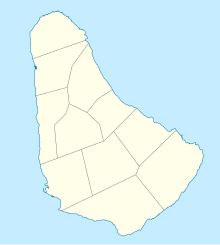
 Barbados airport diagram | |||||||||||
| Runways | |||||||||||
| |||||||||||
| Statistics (2018) | |||||||||||
| |||||||||||
Grantley Adams International Airport (GAIA), (IATA: BGI, ICAO: TBPB) is in Seawell, Christ Church on the island of Barbados. The former name of the airport was Seawell Airport. Then it was named in honour of the first Premier of Barbados, Sir Grantley Herbert Adams in 1976. GAIA is the only port of entry for persons arriving and leaving by air in Barbados.
In 2011, the Grantley Adams Airport was the 9th busiest airport in the Caribbean region.
- ↑ Weather at the Grantley Adams Airport, WeatherCast UK
- ↑ Station Information Listing, NOAA
- ↑ S., D. (4 April 2008). "Brancker: Airport board will enhance tourism". Nation Newspaper. Archived from the original on 9 April 2008. Retrieved 2 June 2010.
- ↑ Airport information for TBPB Archived 2011-08-06 at the Wayback Machine from DAFIF (effective October 2006)
- ↑ Airport information for BGI at Great Circle Mapper. Source: DAFIF (effective Oct. 2006).
