Back هاي بوينت Arabic هاى بوينت، نورث كارولاينا ARZ های پوینت، قوزئی کارولینا AZB High Point (Carolina del Nord) Catalan Гай-Пойнт (Къилбаседа Каролина) CE High Point (lungsod sa Tinipong Bansa, North Carolina, Guilford County) CEB ھای پۆینت CKB High Point Czech High Point, Gogledd Carolina Welsh High Point DAG
High Point, North Carolina | |
|---|---|
 Downtown High Point | |
| Nickname(s): North Carolina's International City,[1] Home Furnishings and Hosiery Capital of the World, City of the Future, HP, Hype Point, The Pocket, The Point | |
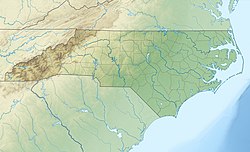
 Location in Guilford County and North Carolina | |
| Coordinates: 35°59′28″N 79°59′37″W / 35.99111°N 79.99361°W | |
| Country | United States |
| State | North Carolina |
| Counties | Guilford, Davidson, Randolph, Forsyth |
| Chartered | May 26, 1859[2] |
| Named for | Highest point of the 1856 North Carolina Railroad[3] |
| Area | |
| • Total | 58.43 sq mi (151.33 km2) |
| • Land | 56.91 sq mi (147.39 km2) |
| • Water | 1.52 sq mi (3.94 km2) 2.60% |
| Elevation | 866 ft (264 m) |
| Population | |
| • Total | 114,059 |
| • Rank | 266th in the United States 9th in North Carolina |
| • Density | 2,004.31/sq mi (773.87/km2) |
| • Urban | 167,830 (US: 215th)[6] |
| • Urban density | 1,665.1/sq mi (642.9/km2) |
| • Metro | 776,566 (US: 75th) |
| Time zone | UTC−5 (EST) |
| • Summer (DST) | UTC−4 (EDT) |
| ZIP Codes | 27260–27265 |
| Area code | 336 |
| FIPS code | 37-31400 |
| GNIS feature ID | 2404696[5] |
| Website | www |
High Point is a city in central North Carolina. In 2020, it had 114,059 people.[7] It is southwest of Greensboro and southeast of Winston-Salem. High Point has furniture, textile and bus manufacturing.
High Point became a town in 1859.[8]
- ↑ "Welcome to High Point NC". City of High Point. Retrieved November 25, 2015.
- ↑ "History of High Point". United States Census Bureau. Retrieved March 11, 2023.
- ↑ "Geography". www.highpointnc.gov. Retrieved December 7, 2022.
- ↑ "ArcGIS REST Services Directory". United States Census Bureau. Retrieved September 20, 2022.
- ↑ 5.0 5.1 U.S. Geological Survey Geographic Names Information System: High Point, North Carolina
- ↑ United States Census Bureau (December 29, 2022). "2020 Census Qualifying Urban Areas and Final Criteria Clarifications". Federal Register.
- ↑ 7.0 7.1 "QuickFacts: High Point city, North Carolina". United States Census Bureau. Retrieved February 23, 2024.
- ↑ David Robinson (1 May 2012). North Carolina By Rail. Lulu.com. p. 38. ISBN 978-1-105-57610-2.


