Back Huila (departement) Afrikaans إدارة هويلا Arabic KolombiaHuilaWinka AVK Uila (departament) Azerbaijani Oilas departaments BAT-SMG Уила (департамент) Bulgarian Huila (departamant) Breton Huila Catalan Departamento del Huila CEB Huila Czech
Department of Huila
Departamento del Huila | |
|---|---|
| Anthem: Alma del Huila (Huila's soul) | |
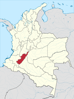
 Huila shown in red | |
 Topography of the department | |
| Coordinates: 2°59′55″N 75°18′16″W / 2.99861°N 75.30444°W | |
| Country | |
| Region | Andean Region |
| Established | 1905 |
| Capital | Neiva |
| Area | |
| • Total | 19,890 km2 (7,680 sq mi) |
| Population (2013)[1] | |
| • Total | 1,126,314 |
| • Density | 57/km2 (150/sq mi) |
| Time zone | UTC-05 |
| ISO 3166 code | CO-HUI |
| Provinces | 4 |
| Municipalities | 37 |
| Website | www.gobhuila.gov.co |
Huila is a department of Colombia. Its capital is Neiva.[2]
The department is located in the southwest of the country. It has Colombia's third highest peak, the Nevado del Huila volcano. The Magdalena River starts in the Huila.
- ↑ "DANE". Archived from the original on November 13, 2009. Retrieved February 13, 2013.
- ↑ "Generalidades del departamento". Gobernación del Huila. Retrieved 26 April 2013.

