Back कर्णाली प्रदेश Bihari কর্ণালী প্রদেশ Bengali/Bangla پارێزگای کارناڵی CKB Karnali (il) CRH Provinz Karnali German कर्णाली प्रदेश DTY Karnali Province English Provinco Karnali Esperanto Provincia de Karnali Spanish کارنالی پرادش Persian
Karnali Pradesh
कर्णाली प्रदेश | |
|---|---|
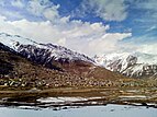
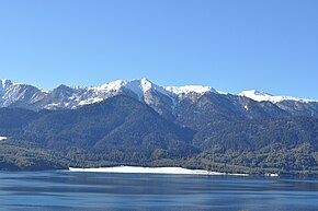
From top going clockwise:Phoksundo lake, Sinja Valley, Simikot, Rara lake, Karnali Bridge and Kanjiroba | |
 Location of Karnali Pradesh | |
 Districts of Karnali Pradesh | |
| Country | |
| Formation | 20 September 2015 |
| Capital | Birendranagar |
| Largest city | Birendranagar |
| Districts | 10 |
| Government | |
| • Body | Government of Karnali Pradesh |
| • Governor | Tilak Pariyar |
| • Chief Minister | Mahendra Bahadur Shahi (NCP) |
| • High Court | Surkhet High Court |
| • Provincial Assembly | Unicameral (40 seats) |
| • Parliamentary constituency | 12 |
| Area | |
| • Total | 27,984 km2 (10,805 sq mi) |
| • Rank | 1st |
| Population (2011) | |
| • Total | 1,570,418 |
| • Rank | 7th |
| • Density | 56/km2 (150/sq mi) |
| • Rank | 7th |
| Demonym | Karnali/Karnalese |
| Time zone | UTC+5:45 (NST) |
| Geocode | NP-SI |
| Main Official Language | Nepali (96.47%) |
| Other Official Language(s) | 1. Magar (1.1%) 2. Tamang (0.9%) |
| HDI | 0.469 (low) |
| Literacy | 62.77% |
| Sex ratio | 95.78 ♂ /100 ♀ (2011) |
| Website | www.karnali.gov.np |
Karnali Province (Nepali: कर्णाली प्रदेश) is one of the seven federal provinces of Nepal.[1] The total area of the province is 27,984 square kilometres (10,805 sq mi). According to the 2011 Nepal census, the population of the province was 1,570,418.
At first it was known as Province No. 6. The Provincial Assembly named this province Karnali Pradesh in February 2018. It borders the Tibet Autonomous Region of China to the north, Gandaki Province to the east, Sudurpashchim Province to the west, and Lumbini Province to the south.[2] Birendranagar is the capital city of the province.[3]
- ↑ "Nepal Provinces". statoids.com. Retrieved 2016-03-21.
- ↑ "Prov 6 named as Karnali, permanent capital in Birendranagar". www.myrepublica.com. 24 February 2018. Retrieved 24 February 2018.
- ↑ "Government finalises provinces' governors and temporary headquarters". nepalekhabar.com. 17 January 2018. Retrieved 19 January 2018.


