Back Southampton Afrikaans Southampton AN ساوثهامبتون Arabic ساوثهامبتون ARZ Southampton AST Sauthempton Azerbaijani ساوتهمپتون AZB Саутгемптон Bashkir Саўтгемптан Byelorussian Саўтгэмптан BE-X-OLD
Southampton | |
|---|---|
City and Unitary authority area | |
 Montage of Southampton. Clockwise from top-left: Bargate; Guildhall; Top of west walls; Wool house and custom house; Southwestern house | |
| Nickname(s): "Soton/So'ton", The Gateway to the World | |
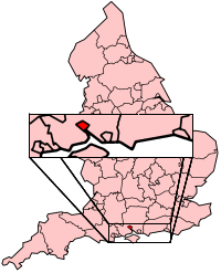
 Southampton shown within Hampshire | |
| Sovereign state | United Kingdom |
| Constituent country | England |
| Region | South East England |
| Ceremonial county | Hampshire |
| Admin HQ | Southampton |
| Settled | c. AD43 |
| City status | 1964 |
| Unitary authority | 1997 |
| Government | |
| • Type | Unitary authority, City |
| • Governing body | Southampton City Council |
| • Leadership | Leader and Cabinet |
| • Executive | |
| • MPs | Royston Smith (C) Alan Whitehead (L) Caroline Nokes (C) |
| Area | |
| • Urban | 28.1 sq mi (72.8 km2) |
| Population (2010 est) | |
| • City and Unitary authority area | 253,651 (Ranked 57)[1] |
| • Density | 13,190/sq mi (5,094/km2) |
| • Urban | 855,569[2] |
| • Metro | 1,547,000[3] |
| • Ethnicity (United Kingdom 2005 Estimate) [4] | 85.9% White (77.7% White British) 8.4% Asian 2.2% Black. 1.2% other 2.4% Mixed Race |
| Demonym | Sotonian |
| Time zone | UTC+0 (Greenwich Mean Time) |
| • Summer (DST) | UTC+1 (British Summer Time) |
| Postcode span | |
| Area code | 023 |
| GVA | 2013 |
| • Total | £9.7 bn ($15.7 bn) (12th) |
| • Growth | |
| • Per capita | £21,400 ($34,300) (15th) |
| • Growth | |
| GDP | US$ 51.6 billion [5] |
| GDP per capita | US$ 37,832[5] |
| Website | www |
Southampton is a city in the United Kingdom. The city is in Hampshire. It is about in the middle of the south coast of England. Southampton is the largest city on the south coast.[6]
It is an important port. It is the nearest city to the New Forest. In 1912, the RMS Titanic sailed from there as was common with most ocean liners at the time. It contains several memorials and museum exhibitions related with the doomed ship.
- ↑ "City statistics and research". Office for National Statistics. Retrieved 16 November 2013.
- ↑ "2011 Census – Built-up areas". ONS. Retrieved 20 July 2013.
- ↑ "British urban pattern: population data" (PDF). ESPON project 1.4.3 Study on Urban Functions. European Union – European Spatial Planning Observation Network. March 2007. pp. 120–121. Archived from the original (PDF) on 24 September 2015. Retrieved 14 May 2011.
- ↑ Neighbourhood Statistics. "Lead View Table". Neighbourhood.statistics.gov.uk. Archived from the original on 12 January 2009. Retrieved 6 May 2009.
- ↑ 5.0 5.1 "Global city GDP 2014". Brookings Institution. Archived from the original on 4 June 2013. Retrieved 18 November 2014.
- ↑ "Southampton - In Brief". stga.org.uk. Retrieved 20 January 2011.