Back ቅየሳ Amharic مساحة (تخصص) Arabic Mərzçəkmə Azerbaijani सर्वेक्षण Bihari ভূমি জরিপ Bengali/Bangla Agrimensura Catalan ڕووپێوی CKB Zeměměřičství Czech Landmåling Danish Vermessung German


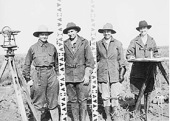
Surveying is the technique and science of accurately finding out the position[1] of points and the distances and angles between them. These points are usually, but not always, associated with positions on the surface of the Earth. They are often used to make land maps and boundaries for ownership of land. A person who does the surveying is called a surveyor. In order to find the information they need, surveyors use geometry, engineering, trigonometry, mathematics, physics, geology and law.
Surveying has been very important in the development of the human environment since the beginning of recorded history (ca. 5000 years ago) and it is a requirement planning of nearly every form of construction. Its most common uses are in the fields of transport, building and construction, communications, mapping, and the making of legal boundaries for land ownership.
- ↑ terrestrial or three-dimensional space