Back Parque Nacional do Araguaia CEB Národní park Araguaia Czech Parque nacional del Araguaia Spanish پارک ملی اراگویا Persian Parc national de l'Araguaia French Արագուայա ազգային պարկ Armenian അരഗ്വൈയ്യ ദേശീയോദ്യാനം Malayalam Nationaal park Araguaia Dutch Parque Nacional do Araguaia Portuguese Арагуая (национальный парк) Russian
| Araguaia National Park | |
|---|---|
| Parque Nacional do Araguaia | |
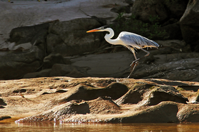
 Heron on the Araguaia River | |
| Coordinates | 10°30′00″S 50°10′01″W / 10.500°S 50.167°W |
| Designation | National park |
| Administrator | ICMBio |
The Araguaia National Park (Parque Nacional do Araguaia) is a national park located in Tocantins state in the north of Brazil, between 09º51’—11º11’S and 49º57’—50º27’W. Bananal Island, on which the park is located, is believed to be the largest inland river island in the world.[1]
- ^ "Bananal Island". Encyclopædia Britannica. Encyclopædia Britannica Inc. 2015. Retrieved 6 September 2015.
