Bellerose | |
|---|---|
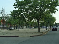
 Wide, tree-lined median on Hillside Avenue | |
 Location within New York City | |
| Coordinates: 40°44′06″N 73°43′12″W / 40.735°N 73.72°W | |
| Country | |
| State | |
| City | |
| County/Borough | |
| Community District | Queens 13[1] |
| Time zone | UTC−5 (EST) |
| • Summer (DST) | UTC−4 (EDT) |
| ZIP Code | 11426 |
| Area codes | 718, 347, 929, and 917 |
Bellerose is an ethnically diverse, middle-class neighborhood on the eastern edge of the New York City borough of Queens, along the border of Queens and Nassau County, Long Island. It is adjacent to Bellerose Village and Bellerose Terrace in Nassau County, from which it is separated by Jericho Turnpike. The northern edge of Bellerose is separated from another part of the Nassau border by the neighborhood of Floral Park, Queens to the east, divided by Little Neck Parkway.
The neighborhood consists predominantly of detached houses with mostly middle-class Indian American and European American populations. While the northeastern section of Queens Village is sometimes referred to as part of Bellerose, it is also called Bellerose Manor, which is recognized by the U.S. Postal Service as an "acceptable alternate" to Queens Village and Jamaica in postal addresses.[2]
Bellerose is located in Queens Community District 13 and its ZIP Code is 11426.[1] It is patrolled by the New York City Police Department's 105th Precinct.
- ^ a b "NYC Planning | Community Profiles". communityprofiles.planning.nyc.gov. New York City Department of City Planning. Retrieved April 7, 2018.
- ^ Bellerose Manor: In a Tale of Pride and ZIP Codes, One Digit Makes All the Difference, The New York Times, September 14, 2003; accessed December 21, 2011
