Back Bodelwyddan Breton Bodelwyddan (kapital sa komunidad) CEB Bodelwyddan Welsh Bodelwyddan German Bodelwyddan Spanish Bodelwyddan Basque بودلویدان Persian Bodelwyddan French Bodelwyddan Irish Bodelwyddan Scots/Gaelic
| Bodelwyddan | |
|---|---|
 | |
Location within Denbighshire | |
| Population | 2,147 (2011) |
| OS grid reference | SJ0075 |
| Community |
|
| Principal area | |
| Preserved county | |
| Country | Wales |
| Sovereign state | United Kingdom |
| Post town | ST. ASAPH |
| Postcode district | LL17 |
| Post town | RHYL |
| Postcode district | LL18 |
| Dialling code | 01745 |
| Police | North Wales |
| Fire | North Wales |
| Ambulance | Welsh |
| UK Parliament | |
| Senedd Cymru – Welsh Parliament | |
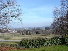
Bodelwyddan (Welsh pronunciation: [bɔdɛlˈwəðan]) is a village, electoral ward and community in Denbighshire, Wales, approximately 5 miles (8 km) south of Rhyl. The parish includes several smaller hamlets such as Marli and Pengwern.
Bodelwyddan is home to over sixty listed buildings[1] including notable locations such as the Marble Church and Bodelwyddan Castle.
The population of only 2,106,[2] increasing to 2,147 at the 2011 census,[3] is served by a single public house, a small number of shops, two takeaways (a Chinese takeaway called The Lucky Garden and the fish and chips shop ‘Church View Chippy’), a primary school and a driving range; as well as having its own community centre.
It is now bypassed by the A55 road, but continues to be a hub of activity due to the presence of Glan Clwyd Hospital. It has a town council with a mayor.[4]
- ^ Listed Buildings in Bodelwyddan - Retrieved April 7, 2013
- ^ "Parish Headcounts: Denbighshire". Neighbourhood Statistics: Census 2001. Office for National Statistics. Archived from the original on 13 June 2011. Retrieved 20 May 2011.
- ^ "Community/Ward population 2011". Retrieved 22 May 2015.
- ^ "Councillors and Contact Details". Archived from the original on 7 April 2014. Retrieved 4 November 2019.

