Brownsville, Vermont | |
|---|---|
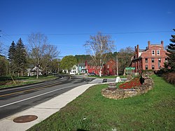
 Brownsville, VT looking west along Route 44 | |
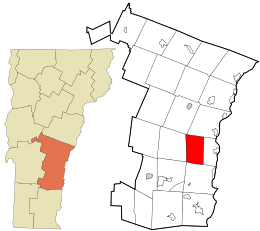
 Location in Windsor County and the state of Vermont. | |
| Coordinates: 43°28′07″N 72°28′15″W / 43.46861°N 72.47083°W | |
| Country | United States |
| State | Vermont |
| County | Windsor |
| Elevation | 682 ft (208 m) |
| Time zone | UTC-5 (Eastern (EST)) |
| • Summer (DST) | UTC-4 (EDT) |
| ZIP code | 05037 |
| Area code | 802 |
| GNIS feature ID | 1456613[1] |
| Website | www |
Brownsville is an unincorporated community in West Windsor, Vermont, United States. Located on Vermont Route 44, the village houses a number of administrative offices for the town of West Windsor.
- ^ a b U.S. Geological Survey Geographic Names Information System: Brownsville, Vermont. Retrieved on 07-04-2019.

