Back كامبريدج (أونتاريو) Arabic كامبريدج (مدينه فى ريجيونال مونيسيپاليتى اوف واتيرلو) ARZ کمبریج، اونتاریو AZB Кембрыдж (Антарыё) BE-X-OLD Cambridge (lungsod sa Kanada) CEB Cambridge (Ontario) German Cambridge, Ontario DIQ Κέιμπριτζ (Οντάριο) Greek Kembriĝo (Ontario) Esperanto کمبریج، انتاریو Persian
Cambridge | |
|---|---|
| City of Cambridge | |
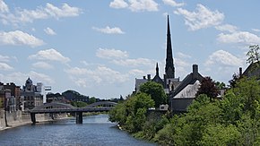
 Grand River scene facing downtown Cambridge (Galt) | |
| Nicknames: The Bridge, the Tri-City | |
| Motto(s): "A fine place for business, a great place to call home." | |
| Coordinates: 43°23′50″N 80°18′41″W / 43.39722°N 80.31139°W | |
| Country | Canada |
| Province | Ontario |
| Region | Waterloo |
| Established | January 1973 |
| Government | |
| • Mayor | Jan Liggett |
| • Governing Body | Cambridge City Council |
| Area | |
| • Land | 112.99 km2 (43.63 sq mi) |
| Elevation | 329 m (1,079 ft) |
| Population | |
• City (lower-tier) | 138,479 (41st) |
| • Density | 1,225.5/km2 (3,174/sq mi) |
| • Metro | 575,847 (10th) |
| Time zone | UTC−5 (Eastern (EST)) |
| Forward sortation area | |
| Area code(s) | 519, 226, and 548 |
| Highways | |
| GNBC Code | FANXK[3] |
| Website | cambridge.ca |
Cambridge is a city in the Regional Municipality of Waterloo, Ontario, Canada, located at the confluence of the Grand and Speed rivers. The city had a population of 138,479 as of the 2021 census.[1] Along with Kitchener and Waterloo, Cambridge is one of the three core cities of Canada's tenth-largest metropolitan area.
Cambridge was formed in 1973 by the amalgamation of Galt, Preston, Hespeler, the settlement of Blair, North Dumfries, as well as east and west Galt.[4] The former Galt covers the largest portion of Cambridge, making up the southern half of the city, while Preston and Blair cover the western side. Hespeler makes up the most northeastern section of Cambridge. Historical information and records of each entity are well documented in the Cambridge City Archives.[5]
- ^ a b "Cambridge, City Ontario". Census profile, Canada 2016 Census. Statistics Canada. 2016. Retrieved March 10, 2017.
- ^ "Population and dwelling counts: Census metropolitan areas, census agglomerations and census subdivisions (municipalities)1". Statistics Canada. February 9, 2022. Archived from the original on February 9, 2022. Retrieved February 9, 2022.
- ^ "Cambridge". Natural Resources Canada. October 6, 2016.
- ^ "About Cambridge Ontario, Canada". City of Cambridge. 2015. Archived from the original on April 28, 2020. Retrieved March 20, 2017.
- ^ "History, Cambridge Ontario". City of Cambridge. 2015. Retrieved March 20, 2017.


