Back نهر سيدار (نهر) ARZ Cedar River (suba sa Tinipong Bansa, Washington, King County) CEB Cedar River (Lake Washington) German Río Cedar (Lago Washington) Spanish Cedar River French
| Cedar River | |
|---|---|
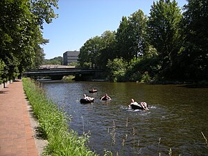
 Cedar River in Downtown Renton in 2009 | |
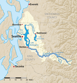
 Map of the Lake Washington drainage basin with the Cedar River highlighted | |
| Location | |
| Country | United States |
| State | Washington |
| County | King |
| Cities | Maple Valley, Renton |
| Physical characteristics | |
| Source | Cascade Range |
| • coordinates | 47°18′47″N 121°31′17″W / 47.31306°N 121.52139°W[1] |
| • elevation | 2,220 ft (680 m)[2] |
| Mouth | Lake Washington |
• coordinates | 47°30′2″N 122°12′58″W / 47.50056°N 122.21611°W[1] |
• elevation | 17 ft (5.2 m)[2] |
| Length | 45 mi (72 km)[3] |
| Basin size | 184 sq mi (480 km2)[4] |
| Discharge | |
| • location | Renton[4] |
| • average | 659 cu ft/s (18.7 m3/s)[4] |
| • minimum | 30 cu ft/s (0.85 m3/s) |
| • maximum | 10,600 cu ft/s (300 m3/s) |
| Basin features | |
| Tributaries | |
| • left | Rex River |
The Cedar River is a river in the U.S. state of Washington. About 45 miles (72 km) long, it originates in the Cascade Range and flows generally west and northwest, emptying into the southern end of Lake Washington. Its upper watershed is a protected area called the Cedar River Watershed, which provides drinking water for the greater Seattle area.
The Cedar River drains into Puget Sound via Lake Washington and the Lake Washington Ship Canal.
- ^ a b U.S. Geological Survey Geographic Names Information System: Cedar River (Washington)
- ^ a b Google Earth elevation for GNIS coordinates.
- ^ Cedar River Archived 2004-11-29 at the Wayback Machine, The Columbia Gazetteer of North America
- ^ a b c Lake Washington Basin, Water Resource Data, Washington, 2005, USGS.

