Back كونواي (نيوهامشير) Arabic کونوای، نیوهمپشایر AZB Conway (Nou Hampshire) Catalan Конвей (Нью-Гэмпшир) CE Conway, New Hampshire Welsh Conway (Nuevo Hampshire) Spanish کانوی، نیوهمپشایر Persian Conway (New Hampshire) French Conway, New Hampshire HT Conway (New Hampshire) Italian
Conway, New Hampshire | |
|---|---|
Town | |
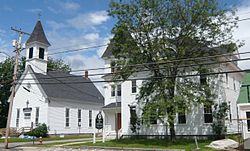
 Town Hall (right) in Center Conway | |
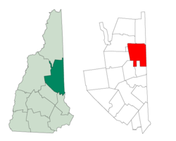
 Location in Carroll County, New Hampshire | |
| Coordinates: 43°58′43″N 71°07′08″W / 43.97861°N 71.11889°W | |
| Country | United States |
| State | New Hampshire |
| County | Carroll |
| Incorporated | 1765 |
| Villages | |
| Government | |
| • Type | New England town |
| • Board of Selectmen |
|
| • Town Manager | John Eastman |
| Area | |
• Total | 71.7 sq mi (185.8 km2) |
| • Land | 69.5 sq mi (180.0 km2) |
| • Water | 2.2 sq mi (5.8 km2) 3.14% |
| Elevation | 465 ft (142 m) |
| Population (2020)[2] | |
• Total | 9,822 |
| • Density | 141/sq mi (54.6/km2) |
| Time zone | UTC-5 (Eastern) |
| • Summer (DST) | UTC-4 (Eastern) |
| ZIP codes | |
| Area code | 603 |
| FIPS code | 33-14660 |
| GNIS feature ID | 0873570 |
| Website | conwaynh |
Conway is a town in Carroll County, New Hampshire, United States. It is the most populous community in the county, with a population of 9,822 at the 2020 census,[2] down from 10,115 at the 2010 census.[3] The town is on the southeastern edge of the White Mountain National Forest. There are five villages in the town: Conway, North Conway, Center Conway, Redstone and Kearsarge. Additionally, it shares a portion of the village of Intervale with the neighboring town of Bartlett.[4]
Conway serves as the main economic and commercial hub for Carroll County. Tourism remains Conway's biggest economic engine, with numerous lodging and rental properties serving visitors to the eastern White Mountains and the Mount Washington Valley, while the technology sector makes up the second largest source of employment. Sites of interest in the town include natural sites such as Cathedral Ledge (popular with climbers), Echo Lake and Conway Lake, as well as several nearby ski resorts. The Conway Scenic Railroad provides day trips to various locations. The village of North Conway features a popular outlet shopping district.
- ^ "2020 U.S. Gazetteer Files – New Hampshire". United States Census Bureau. Retrieved October 29, 2021.
- ^ a b "Conway town, Carroll County, New Hampshire: 2020 DEC Redistricting Data (PL 94-171)". U.S. Census Bureau. Retrieved October 29, 2021.
- ^ United States Census Bureau, U.S. Census website, 2010 Census figures. Retrieved March 23, 2011.
- ^ U.S. Geological Survey North Conway West 7.5 minute topographic map, from Topozone website. Accessed December 24, 2007.