Back مطار ديكورا المحلى ARZ Decorah Municipal Airport CEB فرودگاه شهری دکوراه Persian Aeroportul Municipal Decorah Romanian Фурудгоҳи шаҳре дкуроҳ Tajik ڈیکورا میونسپل ہوائی اڈا Urdu
Decorah Municipal Airport | |||||||||||
|---|---|---|---|---|---|---|---|---|---|---|---|
 | |||||||||||
| Summary | |||||||||||
| Airport type | Public | ||||||||||
| Owner | City of Decorah | ||||||||||
| Serves | Decorah, Iowa | ||||||||||
| Elevation AMSL | 1,158 ft / 353 m | ||||||||||
| Coordinates | 43°16′32″N 091°44′22″W / 43.27556°N 91.73944°W | ||||||||||
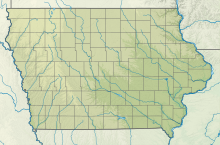
| Map | |||||||||||
 | |||||||||||
| Runways | |||||||||||
| |||||||||||
| Statistics (2007) | |||||||||||
| |||||||||||
Decorah Municipal Airport (IATA: DEH, ICAO: KDEH, FAA LID: DEH) is a city-owned public-use airport located two nautical miles (3.7 km) southeast of the central business district of Decorah, in Winneshiek County, Iowa, United States.[1]
- ^ a b FAA Airport Form 5010 for DEH PDF, effective 2009-07-02.

