Back مقاطعة إيميت (ميشيغان) Arabic Emmet County, Michigan BAR Емит (окръг, Мичиган) Bulgarian এম্মেট কাউন্টি, মিশিগান BPY Emmet Gông (Michigan) CDO Emmet County (kondado sa Tinipong Bansa, Michigan) CEB Emmet County (Michigan) Czech Emmet County, Michigan Welsh Emmet County (Michigan) German Kantono Emmet (Miĉigano) Esperanto
Emmet County | |
|---|---|
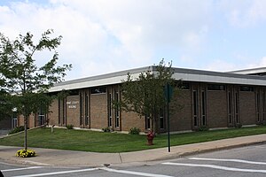
 Emmet County Building | |
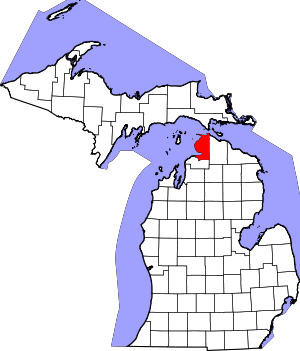
 Location within the U.S. state of Michigan | |
 Michigan's location within the U.S. | |
| Coordinates: 45°35′N 84°59′W / 45.58°N 84.98°W | |
| Country | |
| State | |
| Founded | April 1, 1840[1] |
| Named for | Robert Emmet |
| Seat | Petoskey |
| Largest city | Petoskey |
| Area | |
• Total | 882 sq mi (2,280 km2) |
| • Land | 467 sq mi (1,210 km2) |
| • Water | 415 sq mi (1,070 km2) 47% |
| Population (2020) | |
• Total | 34,112 |
| • Density | 70/sq mi (30/km2) |
| Time zone | UTC−5 (Eastern) |
| • Summer (DST) | UTC−4 (EDT) |
| Congressional district | 1st |
| Website | www |
Emmet County is a county located in the U.S. state of Michigan. As of the 2020 census, the population was 34,112, making it the second-most populous county in Northern Michigan (behind Grand Traverse County).[2] The county seat is Petoskey, which is also the county's largest city.[3]
Emmet County is located at the top of the Lower Peninsula of Michigan, bounded on the west by Lake Michigan and on the north by the Straits of Mackinac. Its rural areas are habitat for several endangered species. Long a center of occupation by the Odawa people, today the county is the base for the federally recognized Little Traverse Bay Bands of Odawa Indians.
- ^ "Bibliography on Emmet County". Clarke Historical Library, Central Michigan University. Archived from the original on February 17, 2013. Retrieved January 19, 2013.
- ^ "State & County QuickFacts". US Census Bureau. Retrieved September 15, 2021.
- ^ "Find a County". National Association of Counties. Retrieved June 7, 2011.