Back إريك (أوكلاهوما) Arabic اريك (بيكهام) ARZ اریک، اوکلاهوما AZB Erick Catalan Эрик (Оклахома) CE Erick CEB Erick (Oklahoma) German Erick (Oklahoma) Spanish Erick (Oklahoma) Basque اریک (اکلاهما) Persian
Erick, Oklahoma | |
|---|---|
 Corner of Sheb Wooley and Roger Miller streets in Erick | |
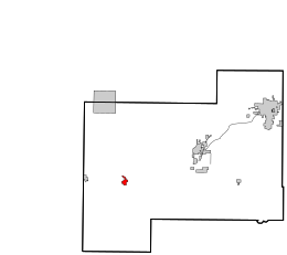
 Location in Beckham County and the state of Oklahoma | |
| Coordinates: 35°12′55″N 99°52′07″W / 35.21528°N 99.86861°W[1] | |
| Country | United States |
| State | Oklahoma |
| County | Beckham |
| Area | |
• Total | 0.94 sq mi (2.45 km2) |
| • Land | 0.94 sq mi (2.45 km2) |
| • Water | 0.00 sq mi (0.00 km2) |
| Elevation | 2,064 ft (629 m) |
| Population (2020) | |
• Total | 1,000 |
| • Density | 1,059.32/sq mi (408.88/km2) |
| Time zone | UTC-6 (Central (CST)) |
| • Summer (DST) | UTC-5 (CDT) |
| ZIP code | 73645 |
| Area code | 580 |
| FIPS code | 40-24200[3] |
| GNIS feature ID | 2410451[1] |

Erick (/ˈɪərɪk/ EER-ik) is a city in Beckham County, Oklahoma, United States. It is located 15 miles (24 km) west of Sayre, the county seat, and 6 miles (9.7 km) east of the Oklahoma-Texas border. The population was an even 1,000 at the time of the 2020 census.[4]
A post office, originally named Dennis, was established to serve the local community on November 8, 1900. This community developed along the Choctaw, Oklahoma and Gulf Railroad line (later the Chicago, Rock Island and Pacific Railway), built in 1902. On November 16, 1901, the name was changed to honor Beeks Erick, the townsite developer and president of the Choctaw Townsite and Improvement Company, and the town incorporated that year.[5]
- ^ a b c U.S. Geological Survey Geographic Names Information System: Erick, Oklahoma
- ^ "ArcGIS REST Services Directory". United States Census Bureau. Retrieved September 20, 2022.
- ^ "U.S. Census website". United States Census Bureau. Retrieved January 31, 2008.
- ^ "Erick (city), Oklahoma". United States Census Bureau. Retrieved August 29, 2023.
- ^ Wilson, Linda D. "Erick.". The Encyclopedia of Oklahoma History and Culture. Oklahoma Historical Society. Retrieved November 19, 2019.