Back Ferrara Afrikaans Ferrara ALS Ferrara AN فرارة Arabic فيرارا ARZ Ferrara AST Ferrara AVK Ferrara Azerbaijani فرارا AZB Ferrara BAR
Ferrara
Fràra (Emilian) | |
|---|---|
| Comune di Ferrara | |
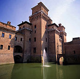
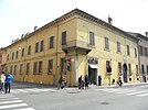
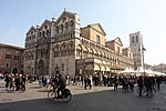
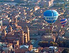
From top left: The Castello Estense, Via Giuseppe Mazzini, Braghini-Rossetti Palace, San Giorgio di Ferrara Cathedral, aerial view of the city during its balloon festival, statue to Nicolò III d'Este in Palazzo Municipale, statue to Girolamo Savonarola in Piazza Savonarola. | |
| Coordinates: 44°50′N 11°37′E / 44.833°N 11.617°E | |
| Country | Italy |
| Region | Emilia-Romagna |
| Province | Ferrara (FE) |
| Frazioni | Aguscello, Albarea, Baura, Boara, Borgo Scoline, Bova, Casaglia, Cassana, Castel Trivellino, Chiesuol del Fosso, Cocomaro di Cona, Cocomaro di Focomorto, Codrea, Cona, Contrapò, Corlo, Correggio, Denore, Focomorto, Francolino, Gaibana, Gaibanella, Sant'Egidio, Malborghetto di Boara, Malborghetto di Correggio, Marrara, Mezzavia, Monestirolo, Montalbano, Parasacco, Pescara, Pontegradella, Pontelagoscuro, Ponte Travagli, Porotto, Porporana, Quartesana, Ravalle, Sabbioni, San Bartolomeo in Bosco, San Martino, Spinazzino, Torre della Fossa, Uccellino, Viconovo, Villanova |
| Government | |
| • Mayor | Alan Fabbri (LN) |
| Area | |
• Total | 404.36 km2 (156.12 sq mi) |
| Elevation | 9 m (30 ft) |
| Population (31 December 2016)[2] | |
• Total | 132,009 |
| • Density | 330/km2 (850/sq mi) |
| Demonyms | Ferraresi, Estensi |
| Time zone | UTC+1 (CET) |
| • Summer (DST) | UTC+2 (CEST) |
| Postal code | 44121 to 44124 |
| Dialing code | 0532 |
| Patron saint | St. George |
| Saint day | April 23 |
| Website | www |
Ferrara (/fəˈrɑːrə/; Italian: [ferˈraːra] ⓘ; Emilian: Fràra [ˈfraːra]) is a city and comune (municipality) in Emilia-Romagna, Northern Italy, capital of the province of Ferrara. As of 2016,[update] it had 132,009 inhabitants.[3] It is situated 44 kilometres (27 miles) northeast of Bologna, on the Po di Volano, a branch channel of the main stream of the Po River, located 5 km (3 miles) north. The town has broad streets and numerous palaces dating from the Renaissance, when it hosted the court of the House of Este.[4] For its beauty and cultural importance, it has been designated by UNESCO as a World Heritage Site.
- ^ "Superficie di Comuni Province e Regioni italiane al 9 ottobre 2011". Italian National Institute of Statistics. Retrieved 16 March 2019.
- ^ "Popolazione Residente al 1° Gennaio 2018". Italian National Institute of Statistics. Retrieved 16 March 2019.
- ^ "Popolazione 2016" (in Italian). Municipality of Ferrara. Retrieved 30 December 2017.
- ^ Cite error: The named reference
EB1911was invoked but never defined (see the help page).


