Back Getafe AN خيتافي Arabic خيتافى (مدينه فى اقليم مدريد) ARZ Getafe AST Getafe Azerbaijani ختافه AZB Хетафэ Byelorussian Хэтафэ BE-X-OLD Хетафе Bulgarian Getafe Breton
Getafe | |
|---|---|
 | |
 Location of Getafe | |
| Coordinates: 40°18′17″N 3°43′52″W / 40.30472°N 3.73111°W | |
| Country | Spain |
| Region | Community of Madrid |
| Founded | Around 1326 |
| Government | |
| • Mayor | Sara Hernández Barroso (2023) (PSOE) |
| Area | |
| 78.74 km2 (30.40 sq mi) | |
| Elevation | 622 m (2,041 ft) |
| Highest elevation | 704 m (2,310 ft) |
| Lowest elevation | 540 m (1,770 ft) |
| Population (2018)[1] | |
| 180,747 | |
• Estimate (2023) | 187,525 |
| • Density | 2,300/km2 (5,900/sq mi) |
| • Urban | 173,057 |
| Demonym | getafense (es) |
| Time zone | UTC+1 (CET) |
| • Summer (DST) | UTC+2 (CEST) |
| Postal code | 28901–28909 |
| Dialing code | +34 (ES) + 91 (M) |
| Website | Official website |
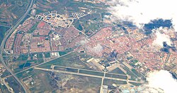
Getafe (Spanish: [xeˈtafe] ⓘ) is a municipality and a city in Spain belonging to the Community of Madrid. As of 2018[update], it has a population of 180,747, the region's sixth most populated municipality.
Getafe is located 13 km south of Madrid's city centre, within a flat area of central Iberia's Meseta Central in the Manzanares River basin. The Cerro de los Ángeles hill, a site traditionally considered to be the geographical center of the Iberian Peninsula, also lies within the municipal limits.[2]
Getafe was a hamlet attached to the Madrid's sexmo of Villaverde during the late Middle Ages. Its proximity to Madrid fostered industrial development during the 20th and 21st centuries. Industrialisation was followed by an increase in population, reaching 170,115 in 2011. Due to its industrial and social networks, the majority of residents work or study within the city. New neighborhoods were developed towards the end of the 20th century.
Getafe hosts an Airbus factory. It is home to the Getafe Air Base, one of the oldest Spanish military air bases, and to the main campus of the Charles III University of Madrid (UC3M).
- ^ Municipal Register of Spain 2018. National Statistics Institute.
- ^ "Cerro de los Ángeles (Official website)" (in Spanish). Retrieved 2009-03-02.

