Back مقاطعة هاميلتون (نيويورك) Arabic Hamilton County, New York BAR Хамилтън (окръг, Ню Йорк) Bulgarian হ্যামিলটন কাউন্টি, নিউ ইয়র্ক BPY Hamilton Gông (New York) CDO Хамильтон (гуо, Нью-Йорк) CE Hamilton County (kondado sa Tinipong Bansa, New York) CEB Hamilton County (New York) Czech Hamilton County, Efrog Newydd Welsh Hamilton County (New York) German
Hamilton County | |
|---|---|
 Hamilton County Courthouse in Lake Pleasant | |
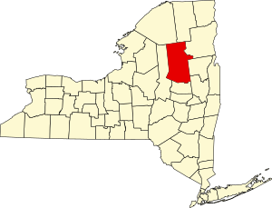
 Location within the U.S. state of New York | |
 New York's location within the U.S. | |
| Coordinates: 43°39′N 74°30′W / 43.65°N 74.5°W | |
| Country | |
| State | |
| Founded | 1816 |
| Named for | Alexander Hamilton |
| Seat | Lake Pleasant |
| Largest CDP | Long Lake |
| Area | |
• Total | 1,808 sq mi (4,680 km2) |
| • Land | 1,717 sq mi (4,450 km2) |
| • Water | 90 sq mi (200 km2) 5.0% |
| Population (2020) | |
• Total | 5,107[1] |
| • Density | 3.0/sq mi (1.2/km2) |
| Time zone | UTC−5 (Eastern) |
| • Summer (DST) | UTC−4 (EDT) |
| Congressional district | 21st |
| Website | www |
Hamilton County is a county in the U.S. state of New York. As of the 2020 census, the population was 5,107,[2] making it the least populous county of New York, and the only county with fewer than 10,000 residents. With a land area nearly the size of Delaware, it is the least densely populated county east of the Mississippi River. Its county seat is Lake Pleasant.[3] The county was created in 1816 and organized in 1847.[4] The county is part of the North Country region of the state.
Hamilton County is one of only two counties that lie entirely within the Adirondack Park (Essex being the other). Because of its location in the park, any development in the county is restricted by the New York State Constitution, which designates the park as "forever wild." There are no permanent traffic lights in the county, and much of the county has no cell phone service.
- ^ "US Census 2020 Population Dataset Tables for New York". United States Census Bureau. Retrieved January 2, 2022.
- ^ "U.S. Census Bureau QuickFacts: Hamilton County, New York". United States Census Bureau. Retrieved January 3, 2022.
- ^ "Find a County". National Association of Counties. Retrieved June 7, 2011.
- ^ "New York: Individual County Chronologies". New York Atlas of Historical County Boundaries. The Newberry Library. 2008. Archived from the original on April 10, 2015. Retrieved January 9, 2015.

