Back نهر هيجلاند كريك ARZ Highland Creek (suba sa Kanada, Ontario, lat 43,77, long -79,15) CEB نهر هایلند Persian ஐலேண்ட் கிரீக் Tamil
| Highland Creek | |
|---|---|
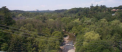
 Highland Creek and its associated valley | |
| Location | |
| Country | Canada |
| Province | Ontario |
| Municipality | Toronto |
| Physical characteristics | |
| Source | Hydro One right of way, near Brimley Road & McNicoll Avenue |
| • coordinates | 43°48′54″N 79°16′51″W / 43.81500°N 79.28083°W |
| • elevation | 186 m (610 ft) |
| Mouth | Lake Ontario |
• coordinates | 43°46′0″N 79°08′41″W / 43.76667°N 79.14472°W |
• elevation | 75 m (246 ft) |
| Length | 29.1 km (18.1 mi) |
| Basin features | |
| Tributaries | |
| • right | West Highland Creek |
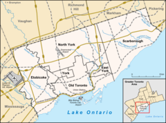
Highland Creek is a river in the Scarborough district of Toronto, Ontario, emptying into Lake Ontario at the eastern end of the Scarborough Bluffs. It is home to several species of fish including trout, carp, bass and salmon. It is a meandering river which, like most rivers in Toronto (including the Don and Humber), travels through a glacial ravine formed after the last Ice Age. The Highland Creek watershed, including tributaries, is almost entirely contained within Scarborough.
