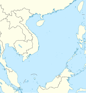
Back Kaohsiung Afrikaans كاوهسيونغ Arabic كاوهسيونج ARZ Гаасюн Byelorussian Гаосюн Bulgarian কাউশিউং Bengali/Bangla ཀའོ་ཞུང་གྲོང་ཁྱེར། Tibetan Kaohsiung Catalan Gŏ̤-hṳ̀ng CDO Гаосюн CE
Kaohsiung City 高雄市[I] Takau, Takao, Takow | |
|---|---|
|
| |
| Etymology: Takao Prefecture | |
| Nickname(s): The Harbor City (Gǎngdū), The Maritime Capital, The Waterfront City | |
 | |
 | |
| Country | |
| Fongshan County | 1683 |
| Takao Prefecture | September 1920 |
| Kaohsiung City | 25 October 1945 |
| Kaohsiung County | 6 December 1945 |
| Upgraded to Yuan-controlled municipality | 1 July 1979 |
| Merger with Kaohsiung County | 25 December 2010 |
| City seat | Lingya District (mayor's office) Fongshan District (City Council) 22°36′54″N 120°17′51″E / 22.61500°N 120.29750°E |
| Districts | 38 |
| Largest district | Sanmin District |
| Government | |
• Mayor | Chen Chi-mai (DPP) |
| Legislature | Kaohsiung City Council |
| National representation | |
| 8 of 113 constituencies | |
| Area | |
• Total | 2,951.85 km2 (1,139.72 sq mi) (4th) |
| Elevation | 9 m (30 ft) |
| Population | |
• October 2023 estimate | 2,737,660 (3rd) 2,565,000 (urban)[1] (3rd) |
| GDP (PPP) | 2016 estimate |
• Total | US$45,285 (12th) |
| GDP (nominal) | 2016 estimate |
• Total | NT$684,260 (12th) |
| Time zone | UTC+8 (National Standard Time) |
| Calling code | 07 |
| Postal code | 800–852 |
| ISO 3166 code | TW-KHH |
| Website | www |
| Symbols | |
| Flower | Chinese hibiscus (Hibiscus rosa-sinensis) |
| Tree | Cotton Tree (Bombax ceiba) |
Legend:
| Kaohsiung City | |||||||||||||||||||||||||||||||||||||
|---|---|---|---|---|---|---|---|---|---|---|---|---|---|---|---|---|---|---|---|---|---|---|---|---|---|---|---|---|---|---|---|---|---|---|---|---|---|
 "Kaohsiung" in Chinese characters | |||||||||||||||||||||||||||||||||||||
| Chinese name | |||||||||||||||||||||||||||||||||||||
| Chinese | 高雄市 | ||||||||||||||||||||||||||||||||||||
| Literal meaning | Japanese transcription of an old Siraya name | ||||||||||||||||||||||||||||||||||||
| |||||||||||||||||||||||||||||||||||||
| Japanese name | |||||||||||||||||||||||||||||||||||||
| Kanji | 高雄市 | ||||||||||||||||||||||||||||||||||||
| Hiragana | たかおし | ||||||||||||||||||||||||||||||||||||
| Katakana | タカオシ | ||||||||||||||||||||||||||||||||||||
| |||||||||||||||||||||||||||||||||||||
Kaohsiung,[a] officially Kaohsiung City,[I] is a special municipality located in southern Taiwan. It ranges from the coastal urban center to the rural Yushan Range with an area of 2,952 km2 (1,140 sq mi). Kaohsiung City has a population of approximately 2.73 million people as of October 2023 and is Taiwan's third most populous city and largest city in southern Taiwan.[4]
Founded in the 17th century as a small trading village named Takau (or Takao,Takow), the city has since grown into the political and economic center of southern Taiwan, with key industries such as manufacturing, steel-making, oil refining, freight transport and shipbuilding. It is classified as a "Gamma −" level global city by the Globalization and World Cities Research Network,[5] with some of the most prominent infrastructures in Taiwan.
Kaohsiung is of strategic importance to the nation as the city is the main port city of Taiwan; the Port of Kaohsiung is the largest and busiest harbor in Taiwan and more than 67% of the nation's exports and imports container throughput goes through Kaohsiung.[6] Kaohsiung International Airport is the second busiest airport in number of passengers in Taiwan. The city is well-connected to other major cities by high speed and conventional rail, as well as several national freeways. It also hosts the Republic of China Navy fleet headquarters and its naval academy. More recent public works such as Pier-2 Art Center, National Kaohsiung Center for the Arts and Kaohsiung Music Center have been aimed at growing the tourism and cultural industries of the city.
Cite error: There are <ref group=upper-roman> tags on this page, but the references will not show without a {{reflist|group=upper-roman}} template (see the help page).
- ^ 高雄市政府主計處全球資訊網 – 首頁. dbaskmg.kcg.gov.tw (in Chinese (Taiwan)). Archived from the original on 11 May 2016. Retrieved 9 September 2018.
- ^ 《中華民國統計資訊網》縣市重要統計指標查詢系統網. Statdb.dgbas.gov.tw (in Traditional Chinese). Archived from the original on 12 June 2016. Retrieved 11 June 2016.
- ^ "Demographia World Urban Areas PDF" (PDF). Demographia. Archived (PDF) from the original on 3 May 2018. Retrieved 1 December 2019.
- ^ 人口統計查詢:本市各區里戶口數月統計. Kaoshiung City Government. Archived from the original on 14 October 2018. Retrieved 4 January 2019.
- ^ "The World According to GaWC 2020". Globalization and World Cities (GaWC) Research Network. Archived from the original on 24 August 2020. Retrieved 31 August 2020.
- ^ "Kaohsiung Harbor volume down 1.9 percent last year". Taipei Times. 8 January 2018. Archived from the original on 31 December 2020. Retrieved 9 February 2021.
Cite error: There are <ref group=lower-alpha> tags or {{efn}} templates on this page, but the references will not show without a {{reflist|group=lower-alpha}} template or {{notelist}} template (see the help page).


