Back Bowemeer Afrikaans بحيرة سوبيريور Arabic ܝܡܬܐ ܕܣܘܦܝܪܝܘܪ ARC بحيره سوبيريور ARZ Llagu Superior AST Yuxarı göl Azerbaijani Үрге күл Bashkir Danu Superior BAN Верхняе (возера) Byelorussian Верхняе (возера) BE-X-OLD
| Lake Superior | |
|---|---|
| Gichi-gami or Anishinaabewi-gichi-gami (Ojibwe) | |
 Lake Superior taken from the International Space Station on June 6, 2019 | |
 Lake Superior bathymetric map.[1][2][3] The deepest point, roughly off its southeastern shore, is marked with "×".[4] The deep trenches in its eastern part may have originated from tunnel valleys.[5][6] | |
| Location | North America |
| Group | Great Lakes |
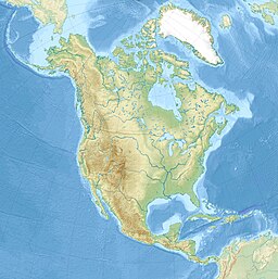
| Coordinates | 47°42′N 87°30′W / 47.7°N 87.5°W |
| Lake type | Glacial |
| Primary inflows | Nipigon, St. Louis, Pigeon, Pic, White, Michipicoten, Kaministiquia, Ontonagon, Tahquamenon Rivers |
| Primary outflows | St. Marys River |
| Catchment area | 49,300 sq mi (128,000 km2)[7] |
| Basin countries | Canada and the United States |
| Max. length | 350 mi (560 km)[8] |
| Max. width | 160 mi (260 km)[8] |
| Surface area | 82,100 km2 (31,700 sq mi)[7] |
| Average depth | 483 ft (147 m)[7] |
| Max. depth | 1,333 ft (406 m)[7][9] |
| Water volume | 12,070 km3 (2,900 cu mi)[7] |
| Residence time | 191 years |
| Shore length1 | 1,729 mi (2,783 km) plus 997 mi (1,605 km) for islands[10] |
| Surface elevation | 601.71 ft (183 m) (2013 average)[11] |
| Islands | Isle Royale, Apostle Islands, Michipicoten Island, Grand Island, Slate Islands |
| Settlements | |
| 1 Shore length is not a well-defined measure. | |
Lake Superior is the largest freshwater lake in the world by surface area[a] and the third-largest freshwater lake by volume,[12] holding 13% of the fresh water in all of the world's rivers and lakes.[13][14] Located in central North America, it is the northernmost and westernmost of the Great Lakes of North America, straddling the Canada–United States border with the Canadian province of Ontario to the north and east and the U.S. states of Minnesota to the west and Michigan and Wisconsin to the south.[15] It drains into Lake Huron via St. Marys River, then through the lower Great Lakes to the St. Lawrence River and ultimately the Atlantic Ocean.
- ^ Cite error: The named reference
GLBathSupwas invoked but never defined (see the help page). - ^ Cite error: The named reference
GLBathHurwas invoked but never defined (see the help page). - ^ Cite error: The named reference
GLOBEwas invoked but never defined (see the help page). - ^ Cite error: The named reference
NOAA_GLERLwas invoked but never defined (see the help page). - ^ Cite error: The named reference
Wright73was invoked but never defined (see the help page). - ^ Cite error: The named reference
Regis73was invoked but never defined (see the help page). - ^ a b c d e Cite error: The named reference
EPAphysicalwas invoked but never defined (see the help page). - ^ a b Cite error: The named reference
EPAfactwas invoked but never defined (see the help page). - ^ Cite error: The named reference
nytwas invoked but never defined (see the help page). - ^ "Shorelines of the Great Lakes". Michigan Department of Environmental Quality. Archived from the original on April 5, 2015.
- ^ "Great Lakes Water Levels" (PDF). United States Army Corps of Engineers. Archived from the original (PDF) on April 18, 2013. Retrieved June 27, 2013. The link also has daily elevations for the current month.
- ^ Bencomo, Phil (October 6, 2015). "Just How Big is Lake Superior?". Lake Superior Magazine. Retrieved July 9, 2021.
- ^ https://www.usgs.gov/special-topics/water-science-school/science/how-much-water-there-earth#overview
- ^ https://www.livescience.com/31952-lake-superior.html
- ^ Minnesota Sea Grant. "Superior Pursuit: Facts About the Greatest Great Lake". University of Minnesota. Archived from the original on July 21, 2017. Retrieved August 9, 2007.
Cite error: There are <ref group=lower-alpha> tags or {{efn}} templates on this page, but the references will not show without a {{reflist|group=lower-alpha}} template or {{notelist}} template (see the help page).
