Back Lake Tahoe Airport CEB Flughafen Lake Tahoe German فرودگاه دریاچه تاهو Persian Aeroportul Lake Tahoe Romanian Фурудгоҳи дарёча тоҳу Tajik لیک تاہو ہوائی اڈا Urdu
Lake Tahoe Airport | |||||||||||
|---|---|---|---|---|---|---|---|---|---|---|---|
 | |||||||||||
| Summary | |||||||||||
| Airport type | Public | ||||||||||
| Owner/Operator | City of South Lake Tahoe | ||||||||||
| Location | South Lake Tahoe, California | ||||||||||
| Elevation AMSL | 6,269 ft / 1,911 m | ||||||||||
| Coordinates | 38°53′38″N 119°59′43″W / 38.89389°N 119.99528°W | ||||||||||
| Website | cityofslt | ||||||||||
 | |||||||||||
| Runways | |||||||||||
| |||||||||||
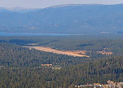
Lake Tahoe Airport (IATA: TVL, ICAO: KTVL, FAA LID: TVL) is a public airport three miles southwest of South Lake Tahoe, in El Dorado County, California. It covers 348 acres (141 ha) and has one runway; it is sometimes called Tahoe Valley Airport. Although the airport had almost forty years of airline service, since 2000, it has served only general aviation.