Back Luxor Afrikaans الأقصر Arabic الاقصر ARZ Əl-Üqsür Azerbaijani اقصر AZB Луксор Byelorussian Луксор Bulgarian লাক্সর Bengali/Bangla Luxor Catalan Luxor (kapital sa lalawigan) CEB
Luxor
الأقصر ⲡⲁⲡⲉ ⲡϣⲟⲙⲧ ⲛ̀ⲕⲁⲥⲧⲣⲟⲛ | |
|---|---|
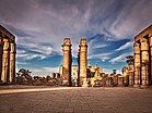
From top, left to right: Buildings on the Nile banks, statue of Ramses II, Luxor Maritim Jolie Ville, Luxor Temple, Luxor Museum, Aerial view of Luxor, Luxor Corniche | |
| Nickname: City of Palaces | |
| Coordinates: 25°41′48″N 32°38′40″E / 25.69667°N 32.64444°E | |
| Country | |
| Governorate | Luxor |
| Area | |
• Total | 417 km2 (161 sq mi) |
| Elevation | 89 m (292 ft) |
| Population (2020)[2] | |
• Total | 263,109 |
| • Density | 630/km2 (1,600/sq mi) |
| • Demonym | Luxorian |
| GDP | |
| • Total | EGP 47 billion (US$ 3 billion) |
| Time zone | UTC+02:00 (EET) |
| Area code | (+20) 95 |
| Website | www |
Luxor[a] is a city in Upper Egypt, which includes the site of the Ancient Egyptian city of Thebes. Luxor had a population of 263,109 in 2020,[2] with an area of approximately 417 km2 (161 sq mi)[1] and is the capital of the Luxor Governorate. It is among the oldest inhabited cities in the world.
Luxor has frequently been characterized as the ''world's greatest open-air museum'', as the ruins of the Egyptian temple complexes at Karnak and Luxor stand within the modern city. Immediately opposite, across the River Nile, lie the monuments, temples and tombs of the West Bank Theban Necropolis, which includes the Valley of the Kings and the Valley of the Queens. Thousands of tourists from all around the world arrive annually to visit Luxor's monuments, contributing greatly to the economy of the modern city. Yusuf Abu al-Haggag is the prominent Muslim historical figure of Luxor.
- ^ a b "Data from Luxor.gov.eg". Archived from the original on June 9, 2007. Retrieved June 4, 2007.
- ^ a b "Annual Bulletin of Births and Deaths Statistics 2020". CAPMAS. December 2021. Archived from the original on October 29, 2023. Retrieved October 29, 2023.
- ^ "GDP BY GOVERNORATE", mped.gov.eg
Cite error: There are <ref group=lower-alpha> tags or {{efn}} templates on this page, but the references will not show without a {{reflist|group=lower-alpha}} template or {{notelist}} template (see the help page).


