Back Mataveri International Airport CEB Flughafen Mataveri German Aeropuerto Internacional Mataveri Spanish فرودگاه بینالمللی ماتاوری Persian Aéroport international Mataveri French נמל התעופה הבין-לאומי מאטאוורי HE Mataveri nemzetközi repülőtér Hungarian Bandar Udara Internasional Mataveri ID Aeroporto Internazionale di Mataveri Italian マタベリ国際空港 Japanese
Mataveri International Airport Isla de Pascua Airport | |||||||||||
|---|---|---|---|---|---|---|---|---|---|---|---|
 A LAN Chile aircraft at Mataveri in 2001 | |||||||||||
| Summary | |||||||||||
| Airport type | Military/Public | ||||||||||
| Operator | FACH – Fuerza Aérea de Chile (Chilean Air Force) | ||||||||||
| Location | Mataveri | ||||||||||
| Elevation AMSL | 227 ft / 69 m | ||||||||||
| Coordinates | 27°09′53″S 109°25′18″W / 27.16472°S 109.42167°W | ||||||||||
| Map | |||||||||||
 | |||||||||||
| Runways | |||||||||||
| |||||||||||
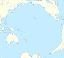
Mataveri International Airport or Isla de Pascua Airport (IATA: IPC, ICAO: SCIP) is at Hanga Roa on Easter Island (Isla de Pascua in Spanish). The most remote airport in the world (defined as distance to another airport),[5] it is 2,336 miles (3,759 km) from Santiago, Chile (SCL) which has scheduled flights to it on the Chilean carrier LATAM Chile. The runway starts just inland from the island's southeast coast at Mataveri, and nearly reaches the west coast, almost separating the mountain of Rano Kau from the rest of the island. The airport is the main point of entry for visitors to Easter Island. It has a transit lounge that was formerly used by passengers continuing to or returning from Papeete, Tahiti, which was serviced by LATAM until June 2020.
- ^ Cite error: The named reference
WMOwas invoked but never defined (see the help page). - ^ Airport information for Mataveri International Airport at Great Circle Mapper.
- ^ Mataveri Airport SkyVector
- ^ "Mataveri International Airport". Google Maps. Retrieved 10 December 2017.
- ^ Davies, Jason (3 October 2014). "World Airports Voronoi". Retrieved 3 October 2014.
