Back ماتسوموتو (ناغانو) Arabic Matsumoto Azerbaijani ماتسوموتو، ناقانو AZB Мацумото Bulgarian Matsumoto (ciutat) Catalan Мацумото (гӀала) CE Matsumoto (lungsod sa Hapon) CEB ماتسومۆتۆ، ناگانۆ CKB Macumoto Czech Matsumoto Danish
Matsumoto
松本市 | |
|---|---|
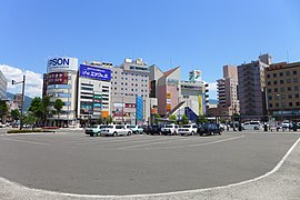
 From top (left to right): Matsumoto Castle, A heritage building of Kaichi School, A view of Kamikōchi, Mount Yake and Azusa River, Nawate souvenir shopping street, A street view of Asama Spa. | |
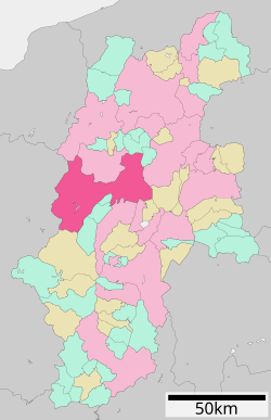
 Location of Matsumoto in Nagano Prefecture | |
 | |
| Coordinates: 36°14′16.8″N 137°58′19.1″E / 36.238000°N 137.971972°E | |
| Country | Japan |
| Region | Chūbu (Kōshin'etsu) |
| Prefecture | Nagano Prefecture |
| First official recorded | 4th century |
| City settled | May 1, 1907 |
| Government | |
| • Mayor | Yoshinao Gaun |
| Area | |
• Total | 978.47 km2 (377.79 sq mi) |
| Population (March 1, 2019) | |
• Total | 239,466 |
| • Density | 240/km2 (630/sq mi) |
| Time zone | UTC+9 (Japan Standard Time) |
| Phone number | 0263-34-3000 |
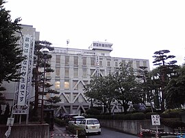
| Address | 3–7 Marunouchi, Matsumoto-shi, Nagano-ken 390-8620 |
| Climate | Cfa/Dfa |
| Website | Official website |
| Symbols | |
| Flower | Japanese azalea |
| Tree | Japanese Red Pine |


Matsumoto (松本市, Matsumoto-shi) is a city located in Nagano Prefecture, Japan.[1] Matsumoto is designated as a core city since 1 April 2021.[2] As of 1 March 2019[update], the city had a population of 239,466 in 105,207 households[3] and a population density of 240 persons per km2. The total area of the city is 978.47 square kilometres (377.79 sq mi).
- ^ Nussbaum, Louis-Frédéric. (2005). "Maatsumoto" in Japan Encyclopedia, p. 618; "Chūbu" at p. 126.
- ^ Jacobs, A. J. "Japan's Evolving Nested Municipal Hierarchy: The Race for Local Power in the 2000s", Urban Studies Research, (2011); Table 3; retrieved 20132-2-11.
- ^ "松本市ホームぺージ". www.city.matsumoto.nagano.jp.


