Maunu | |
|---|---|
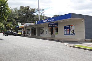
 The small block of shops at Tui Crescent | |
 | |
| Coordinates: 35°44′36″S 174°16′38″E / 35.743195°S 174.277323°E | |
| Country | New Zealand |
| City | Whangarei |
| Electoral ward |
|
| Area | |
| • Land | 565 ha (1,396 acres) |
| Population (June 2024)[2] | |
• Total | 2,820 |
| Postcode(s) | 0110 |
| Woodhill | Horahora | |
| Maungatapere |
|
Raumanga |
| Otaika Valley | Otaika | Morningside |
Maunu is a suburb in the south west of Whangārei in Northland, New Zealand. A volcanic hill to the west is also called Maunu and has a peak 395 m above sea level. State Highway 14 runs through the suburb.[3]
- ^ Cite error: The named reference
Areawas invoked but never defined (see the help page). - ^ "Aotearoa Data Explorer". Statistics New Zealand. Retrieved 26 October 2024.
- ^ Roger Smith, GeographX (2005). The Geographic Atlas of New Zealand. Robbie Burton. pp. map 24. ISBN 1-877333-20-4.
