Back Mosselbaai Afrikaans Mossel Flēot ANG خليج موسيل Arabic خليج موسيل ARZ Мосъл Бей Bulgarian Mossel Bay (kapital sa munisipyo) CEB Mossel Bay Danish Mossel Bay German Mossel Bay Esperanto Mosselbaai Spanish
This article needs additional citations for verification. (October 2022) |
Mossel Bay
Mosselbaai | |
|---|---|
|
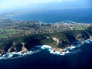
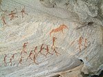
From top, an aerial view of Mossel Bay. A view of the port at Mossel Bay (centre left). World War I war memorial (centre right). A view down Marsh Street of downtown Mossel Bay (bottom left). xam rock art just outside of Mossel bay (bottom right). | |
| Motto(s): Jure et Justitia Valemus (Latin: We are strong in law and justice) | |
| Coordinates: 34°11′00″S 22°08′00″E / 34.18333°S 22.13333°E | |
| Country | South Africa |
| Province | Western Cape |
| District | Garden Route |
| Municipality | Mossel Bay |
| Established | 1848 |
| Area | |
• Total | 36.8 km2 (14.2 sq mi) |
| Population (2011)[1] | |
• Total | 99,000 |
| • Density | 2,700/km2 (7,000/sq mi) |
| Racial makeup (2011) | |
| • Black African | 12.7% |
| • Coloured | 51.5% |
| • Indian/Asian | 0.8% |
| • White | 34.3% |
| • Other | 0.7% |
| First languages (2011) | |
| • Afrikaans | 81.5% |
| • English | 9.2% |
| • Xhosa | 6.5% |
| • Other | 2.8% |
| Time zone | UTC+2 (SAST) |
| Postal code (street) | 6506 |
| PO box | 6500 |
| Area code | 044 |
Mossel Bay (Afrikaans: Mosselbaai) is a harbour town of about 170,000 people on the Garden Route of South Africa. It is an important tourism and farming region of the Western Cape Province. Mossel Bay lies 400 kilometres east of the country's seat of parliament, Cape Town (which is also the capital city of the Western Cape), and 400 km west of Gqeberha, the largest city in the Eastern Cape. The older parts of the town occupy the north-facing side of the Cape St Blaize Peninsula, whilst the newer suburbs straddle the Peninsula and have spread eastwards along the sandy shore of the Bay.
The town's economy relied heavily on farming, fishing and its commercial harbour (the smallest in the Transnet Port Authority's stable of South African commercial harbours),[2] until the 1969 discovery of natural offshore gas fields led to the development of the gas-to-liquids refinery operated by PetroSA. Tourism is another important driver of Mossel Bay's economy.
- ^ a b c d Main Place Mossel Bay from Census 2011.
- ^ "Transnet Port Authority". Retrieved 29 November 2023.


