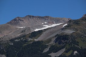
| Mount Hood Wilderness | |
|---|---|
 On the northern flank of Mount Hood, Barrett Spur, 7,863 feet (2,397 m), divides Ladd Glacier (center) from its eastern neighbor, Coe Glacier. | |
 | |
| Location | Clackamas / Hood River counties, Oregon, USA |
| Nearest city | Government Camp, Oregon |
| Coordinates | 45°23′N 121°45′W / 45.383°N 121.750°W |
| Area | 64,742 acres (262.00 km2) |
| Established | 1964 |
| Governing body | U.S. Forest Service |
The Mount Hood Wilderness is a protected wilderness area inside the Mount Hood National Forest, in the U.S. state of Oregon. The area, covering 64,742 acres (26,200 ha), includes the peak of Mount Hood and its upper slopes, and ranges from temperate rain forests at the lower elevations, to glaciers and rocky ridges at higher elevations.
The wilderness wraps around the mountain from west to northeast, and borders Timberline Lodge and Mount Hood Meadows ski lifts on some of the south and east slopes of the mountain.
