Back N'Djamena Afrikaans ንጃመና Amharic N'Djamena AN انجمينا Arabic انجمينا ARZ Xamena AST N'Djamena AVK Ncamena Azerbaijani انجامنا AZB Нджамена Bashkir
N'Djamena
Fort-Lamy | |
|---|---|
|
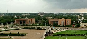
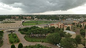
Top: N'Djamena skyline; Middle: National Assembly of Chad, Nation Square (Place de la Nation); Bottom: Downtown N'Djamena | |
| Coordinates: 12°06′19″N 15°02′41″E / 12.10528°N 15.04472°E | |
| Country | |
| Area | |
| 104 km2 (40 sq mi) | |
| • Metro | 166 km2 (64 sq mi) |
| Elevation | 298 m (978 ft) |
| Population (2009 census)[1] | |
| 807,000 | |
| • Density | 9,148/km2 (23,690/sq mi) |
| • Metro | 1,605,696 |
| Time zone | UTC+01:00 (WAT) |
| Area code | 235 |
| ISO 3166 code | TD-ND |
| HDI (2021) | 0.432[2] low · 1st |
N'Djamena[a] (English: /əndʒɑːˈmeɪnə/ ⓘ ən-jah-MAY-nə[3][4]) is the capital and largest city of Chad. It is also a special statute region, divided into 10 districts or arrondissements, similar to the city of Paris.
The city serves as the centre of economic activity in Chad. Meat, fish and cotton processing are the chief industries, and it is a regional market for livestock, salt, dates, and grains.
It is a port city located at the confluence of the Logone River with the Chari River, forming a transborder agglomeration with the city of Kousséri (in Cameroon), capital of the Department of Logone-et-Chari, which is on the west bank of both rivers.[5]
- ^ "World Gazetteer". Archived from the original on 11 January 2013.
- ^ "Sub-national HDI – Area Database – Global Data Lab". hdi.globaldatalab.org. Archived from the original on 2018-09-23. Retrieved 2018-09-13.
- ^ "Definition of N'Djamena". Merriam-Webster.com Dictionary. Merriam-Webster. Retrieved 17 September 2022.
- ^ "N'Djamena". Lexico UK English Dictionary US English Dictionary. Oxford University Press. Archived from the original on 2022-01-26.
- ^ Cahiers de l'Afrique de l'Ouest Dynamiques de l'Urbanisation Africaine 2020: Africapolis, Une Nouvelle Géographie Urbaine. OECD. 20 February 2020
Cite error: There are <ref group=lower-alpha> tags or {{efn}} templates on this page, but the references will not show without a {{reflist|group=lower-alpha}} template or {{notelist}} template (see the help page).


