Back منطقة نوبادا Arabic نوبادا ARZ नुआपाड़ा जिला Bihari নোয়াপাড়া জেলা Bengali/Bangla Nuapada CEB Nuapada (Distrikt) German Distrito de Nuapada Spanish Nuapada barrutia Basque بخش نواپادا Persian Nuapadan piirikunta Finnish
This article needs additional citations for verification. (June 2019) |
Nuapada district | |
|---|---|
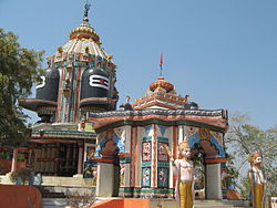
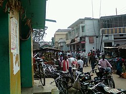
Top: Yogeswar Temple, Patora Bottom: Street in Khariar | |
 Location in Odisha | |
| Coordinates: 20°39′00″N 82°49′59″E / 20.65°N 82.833°E | |
| Country | |
| State | |
| Established | 27 March 1993 |
| Headquarters | Nuapada |
| Government | |
| • Collector & District Magistrate | Hemakanta Sahay, IAS |
| • Divisional Forest Officer Cum Wildlife Warden | Khushwant Singh, IFS |
| • Superintendent of Police | Gundala Reddy Raghavendra IPS |
| Area | |
• Total | 3,408 km2 (1,316 sq mi) |
| Population (2011)[1] | |
• Total | 610,382 |
| • Density | 157/km2 (410/sq mi) |
| Languages | |
| • Official | Odia, English |
| Time zone | UTC+5:30 (IST) |
| PIN | 766105 |
| Vehicle registration | OD-26 |
| Sex ratio | 1020 ♂/♀ |
| Literacy | 58.20% |
| Lok Sabha constituency | Kalahandi |
| Vidhan Sabha constituency | 2 |
| Climate | Aw (Köppen) |
| Precipitation | 1,230 millimetres (48 in) |
| Website | www |
| This article is part of a series on |
| Odisha |
|---|
 |
| Governance |
| Topics |
|
Districts Divisions |
| GI Products |
|
|
Nuapada district is located in the Odisha state in India, with the town of Nuapada serving as the headquarters of the district. It has one subdivision: Nuapada, and five blocks: Khariar, Sinapali, Boden, Komna, and Nuapada. Nuapada District has three Notified Area Councils: Khariar, Khariar Road, and Nuapada, six tehsils in addition to villages, such as Gandabahali, Tukla, Hatibandha, Duajher, Bargaon, Tarbod, Udyanbandh,Singjhar,Brahmanpada,Karngamal,Sarabong,Dharambandha,Lakhna,Sunabeda,Beltukri,Bhela,Niljee, and Larka.

