Back مقاطعة أوكانوغان (واشنطن) Arabic Okanogan County, Washington BAR Оканоган (окръг) Bulgarian ওকানোগান কাউন্টি, ৱাশিংটন BPY Okanogan Gông (Washington) CDO Оканоган (гуо, Вашингтон) CE Okanogan County CEB Okanogan County Czech Okanogan County, Washington Welsh Okanogan County German
Okanogan County | |
|---|---|
 Okanogan County Courthouse in Okanogan | |
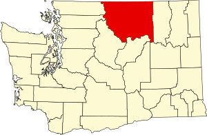
 Location within the U.S. state of Washington | |
 Washington's location within the U.S. | |
| Coordinates: 48°32′54″N 119°44′32″W / 48.54833°N 119.74222°W | |
| Country | |
| State | |
| Founded | February 2, 1888 |
| Named for | Fort Okanogan |
| Seat | Okanogan |
| Largest city | Omak |
| Area | |
• Total | 5,312.7 sq mi (13,760 km2) |
| • Land | 5,266.2 sq mi (13,639 km2) |
| • Water | 46.5 sq mi (120 km2) 0.9% |
| Population (2020) | |
• Total | 42,104 |
• Estimate (2023) | 43,712 |
| • Density | 8.3/sq mi (3.2/km2) |
| Time zone | UTC−8 (Pacific) |
| • Summer (DST) | UTC−7 (PDT) |
| Congressional district | 4th |
| Website | okanogancounty.org |
Okanogan County (/ˌoʊkəˈnɑːɡən/)[1] is a county located in the U.S. state of Washington along the Canada–U.S. border. As of the 2020 census, the population was 42,104.[2] The county seat is Okanogan,[3] while the most populous city is Omak. Its area is the largest in the state.[4]
About a fifth of the county's residents live in the Greater Omak Area. The county forms a portion of the Okanogan Country. The first county seat was Ruby, which has now been a ghost town for more than 100 years.
Okanogan County was formed out of Stevens County in February 1888.[5] The name derives from the Okanagan language place name ukʷnaqín.[6] The name Okanogan (Okanagan) also refers to a part of southern British Columbia.
- ^ "Washington Placenames Pronunciation". Washington County Highpoint Trip Reports.
- ^ "State & County QuickFacts". United States Census Bureau. Retrieved November 9, 2024.
- ^ "Find a County". National Association of Counties. Archived from the original on May 31, 2011. Retrieved June 7, 2011.
- ^ Wilma, David (January 21, 2006). "Okanogan County — Thumbnail History". HistoryLink.org.
- ^ "Washington State Archives – Central Regional Branch: Guide to Holdings: Okanogan County". Retrieved December 31, 2007.
- ^ Bright, William (2004). Native American placenames of the United States. University of Oklahoma Press. p. 346. ISBN 978-0-8061-3598-4. Retrieved September 16, 2011.
