Okuku | |
|---|---|
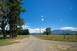
 Okuku countryside | |
 | |
| Coordinates: 43°14′46″S 172°27′07″E / 43.246°S 172.452°E | |
| Country | New Zealand |
| Region | Canterbury |
| Territorial authority | Waimakariri District |
| Ward |
|
| Community |
|
| Electorates | |
| Government | |
| • Territorial Authority | Waimakariri District Council |
| • Regional council | Environment Canterbury |
| • Mayor of Waimakariri | Dan Gordon |
| • Kaikoura/Waimakariri MPs | Stuart Smith/Matt Doocey |
| • Te Tai Tonga MP | Tākuta Ferris |
| Area | |
• Total | 834.79 km2 (322.31 sq mi) |
| Population (June 2024)[2] | |
• Total | 810 |
| • Density | 0.97/km2 (2.5/sq mi) |
Okuku is a small farming community located in North Canterbury, New Zealand, lying 20 kilometres northwest of Rangiora. Okuku consists of a mix of flat and undulating farmland, and river beds that drain a catchment area in the foothills to the north. Okuku is bounded to the south by the Ashley River / Rakahuri (the major river in the area), to the east by the Okuku River, and to the west by the Garry River. Mount Thomas is the highest point at a height of 1023m.[3]
- ^ Cite error: The named reference
Areawas invoked but never defined (see the help page). - ^ "Aotearoa Data Explorer". Statistics New Zealand. Retrieved 26 October 2024.
- ^ "New Zealand Topographic Map - NZ Topo Map". NZ Topo Map. Retrieved 30 October 2015.
