Back اورتوفوتو Arabic Ortofotografia Catalan Ortofoto Danish Orthofoto German Ortofotografía Spanish Ortofoto Estonian Ortoargazki Basque ارتوفتو Persian Orthophotographie French Ortofotografía Galician
This article includes a list of general references, but it lacks sufficient corresponding inline citations. (February 2009) |


An orthophoto, orthophotograph, orthoimage or orthoimagery is an aerial photograph or satellite imagery geometrically corrected ("orthorectified") such that the scale is uniform: the photo or image follows a given map projection. Unlike an uncorrected aerial photograph, an orthophoto can be used to measure true distances, because it is an accurate representation of the Earth's surface, having been adjusted for topographic relief,[1] lens distortion, and camera tilt.
Orthophotographs are commonly used in geographic information systems (GIS) as a "map accurate" background image. An orthorectified image differs from "rubber sheeted" rectifications as the latter may accurately locate a number of points on each image but "stretch" the area between so scale may not be uniform across the image. A digital elevation model (DEM) is required to create an accurate orthophoto as distortions in the image due to the varying distance between the camera/sensor and different points on the ground need to be corrected. An orthoimage and a "rubber sheeted" image can both be said to have been "georeferenced"; however, the overall accuracy of the rectification varies. Software can display the orthophoto and allow an operator to digitize or place linework, text annotations or geographic symbols (such as hospitals, schools, and fire stations). Some software can process the orthophoto and produce the linework automatically.
Production of orthophotos was historically achieved using mechanical devices.[2]
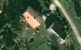
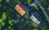
The orthorectification is not always perfect and has side effect especially for the geometry of high-rise constructions.
- ^ Smith, Gary S. "Digital orthophotography and GIS." ESRI Conference. http://proceedings.esri.com/library/userconf/proc95/to150/p124.html
- ^ BBC Tomorrow's World: How maps are corrected and updated using aerial photography and optical machinery. 18 December 1970.