Back بيترسهام (ماساتشوستس) Arabic بيترسهام ARZ Petersham Catalan Питершем (Массачусетс) CE Petersham CEB Petersham, Massachusetts Welsh Petersham (Massachusetts) Spanish Petersham (Massachusetts) Basque پیترشم، ماساچوست Persian Petersham (Massachusetts) French
This article needs additional citations for verification. (January 2024) |
Petersham, Massachusetts | |
|---|---|
 | |
 Location in Worcester County and the state of Massachusetts. | |
| Coordinates: 42°29′15″N 72°11′15″W / 42.48750°N 72.18750°W | |
| Country | United States |
| State | Massachusetts |
| County | Worcester |
| Settled | 1733 |
| Incorporated | 1754 |
| Government | |
| • Type | Open town meeting |
| Area | |
• Total | 68.3 sq mi (176.9 km2) |
| • Land | 54.2 sq mi (140.5 km2) |
| • Water | 14.1 sq mi (36.4 km2) |
| Elevation | 1,080 ft (329 m) |
| Population (2020) | |
• Total | 1,194 |
| • Density | 17/sq mi (6.7/km2) |
| Time zone | UTC-5 (Eastern) |
| • Summer (DST) | UTC-4 (Eastern) |
| ZIP code | 01366 |
| Area code | 351 / 978 |
| FIPS code | 25-53120 |
| GNIS feature ID | 0619486 |
| Website | townofpetersham |
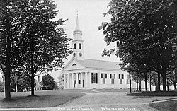
Petersham /ˈpiːtərsæm/ is a town in Worcester County, Massachusetts, United States. The population was 1,194 at the 2020 census.[1] Petersham is home to a considerable amount of conservation land, including the Quabbin Reservation, Harvard Forest, the Swift River Reservation, and Federated Women's Club State Forest.
- ^ "Census - Geography Profile: Petersham town, Worcester County, Massachusetts". United States Census Bureau. Retrieved November 12, 2021.
