Back کوئبرادیلاس، پورتو ریکو AZB কুয়েব্রাডিল্লাস, পুয়ের্তো রিকো BPY Quebradillas (Puerto Rico) Catalan Quebradillas Municipio CEB Quebradillas German Quebradillas Esperanto Quebradillas Spanish کوئبرادیلاس، پورتو ریکو Persian Quebradillas French کبرادياس (پؤرتؤريکؤ) GLK
Quebradillas
Municipio de Quebradillas | |
|---|---|
Town and Municipality | |
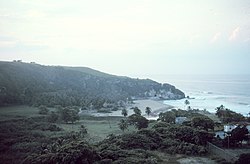
 Quebradillas Beach | |
| Nicknames: "La Guarida del Pirata", "La Ciudad del Cooperativismo" | |
| Anthem: "De lejos canto, porque anhela el corazón" | |
 Map of Puerto Rico highlighting Quebradillas Municipality | |
| Coordinates: 18°28′26″N 66°56′19″W / 18.47389°N 66.93861°W | |
| Sovereign state | United States |
| Commonwealth | Puerto Rico |
| Settled | 1820 |
| Founded | June 6, 1823 |
| Founded by | José Ramos Velez |
| Barrios | |
| Government | |
| • Mayor | Heriberto Vélez (PPD) |
| • Senatorial dist. | 3 – Arecibo |
| • Representative dist. | 15 |
| Area | |
• Total | 27.7 sq mi (58.8 km2) |
| • Land | 23.2 sq mi (60 km2) |
| • Water | 4.5 sq mi (11.66 km2) |
| Population (2020)[2] | |
• Total | 23,638 |
| • Rank | 51st in Puerto Rico |
| • Density | 850/sq mi (400/km2) |
| Demonym | Quebradillanos |
| Time zone | UTC−4 (AST) |
| ZIP Code | 00678 |
| Area code | 787/939 |
| Major routes | |
| Website | www |
Quebradillas (Spanish pronunciation: [keβɾaˈðiʎas], locally [keβɾaˈðiʎaʔ]) is a town and municipality of the island of Puerto Rico located in the northern shore bordering the Atlantic Ocean, north of San Sebastián; east of Isabela; and west of Camuy. Quebradillas is spread over seven barrios and Quebradillas Pueblo (the downtown area and the administrative center of the city). It is part of the San Juan-Caguas-Guaynabo Metropolitan Statistical Area.
Quebradillas is called "La Guarida del Pirata" (The Pirate's Hideout). A well-known beach in the area, Puerto Hermina, is home to an old structure known to have been a hiding place for pirates and their contraband.
- ^ "El Nuevo Día". María, un nombre que no vamos a olvidar. (in Spanish). Retrieved August 28, 2021.
- ^ "PUERTO RICO: 2020 Census". The United States Census Bureau. United States Census Bureau. Retrieved August 25, 2021.

