Back نهر بوين ARZ An Bhóinn Breton Riu Boyne Catalan River Boyne CEB Boyne Czech Бойн CV Afon Boyne Welsh Boyne German Boyne Spanish Boyne Estonian
| River Boyne | |
|---|---|
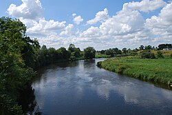
 River Boyne at Brú na Bóinne | |
 | |
| Etymology | Proto-Celtic *bou-windā, "white cow" |
| Native name | An Bhóinn (Irish) |
| Location | |
| Country | Ireland |
| Region | Leinster |
| Counties | Kildare, Offaly, Meath, Louth |
| Physical characteristics | |
| Source | Trinity Well, Newberry Hall, near Carbury |
| • location | County Kildare |
| • coordinates | 53°21′07″N 6°57′25″W / 53.351906542854074°N 6.956809100021702°W |
| Mouth | Irish Sea |
• location | Between Mornington, County Meath, and Baltray, County Louth |
• coordinates | 53°43′18″N 6°14′17″W / 53.72173°N 6.23813°W |
| Length | 112 km (70 mi) |
| Basin size | 2,695 km2 (1,041 sq mi) |
| Discharge | |
| • average | 38.8 m3/s (1,370 cu ft/s) |
| Basin features | |
| Tributaries | |
| • right | River Blackwater |

The River Boyne (Irish: An Bhóinn or Abhainn na Bóinne) is a river in Leinster, Ireland, the course of which is about 112 kilometres (70 mi) long. It rises at Trinity Well, Newberry Hall, near Carbury, County Kildare, and flows north-east through County Meath to reach the Irish Sea between Mornington, County Meath, and Baltray, County Louth.