Back Witwatersrand Afrikaans ويتووترسراند Arabic ويتواترسراند ARZ Вітватэрсранд Byelorussian Witwatersrand (kabukiran) CEB Witwatersrand Czech Witwatersrand German Witwatersrand Esperanto Witwatersrand Spanish Witwatersrand Basque
| Witwatersrand | |
|---|---|
 Witpoortjie Falls in the Walter Sisulu National Botanical Garden, formerly the Witwatersrand National Botanical Gardens. Waterfalls like this, cascading over a 56-kilometre-long (35 mi) quartzite ridge in Gauteng gave rise to the name “Witwatersrand”, which means “white water ridge” in Afrikaans. | |
| Highest point | |
| Elevation | 1,913 m (6,276 ft) |
| Coordinates | 26°12′13″S 28°2′34″E / 26.20361°S 28.04278°E |
| Dimensions | |
| Length | 56 km (35 mi) ESE/WNW |
| Width | 10 km (6.2 mi) NNE/SSW |
| Geography | |
| Country | South Africa |
| Provinces | |
| Geology | |
| Orogeny | Vredefort impact structure |
| Rock age | Archean |
| Rock types | |
| Climbing | |
| Easiest route | From Gauteng or Pretoria |
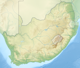
The Witwatersrand (UK: /wɪtˈwɔːtərzrænd, -rɑːnd/, US also /ˈwɪtwɔːtərz-/;[1] Afrikaans pronunciation: [ˌvətˌvɑːtərsˈrant]; locally the Rand or, less commonly, the Reef) is a 56-kilometre-long (35 mi), north-facing scarp in South Africa. It consists of a hard, erosion-resistant quartzite metamorphic rock, over which several north-flowing rivers form waterfalls, which account for the name Witwatersrand, meaning 'white water ridge' in Afrikaans.[2] This east-west-running scarp can be traced with only one short gap, from Bedfordview (about 10 km [6.2 mi] west of O.R. Tambo International Airport) in the east, through Johannesburg and Roodepoort, to Krugersdorp in the west (see the diagram at left below).[3]
The scarp forms the northern edge of a 7-to-10-kilometre-wide (4–6 mi) plateau (or ridge) which rises about 200 m (660 ft) above the surrounding plains of the Highveld. A number of picturesque Johannesburg suburbs, including Observatory, Linksfield Ridge and Upper Houghton are located along the scarp, overlooking the rest of northern Johannesburg with views up to the Magaliesburg[4] (although locals refer to segments of the scarp using area-specific names, such as Linksfield Ridge, Parktown Ridge or Observatory Ridge).[5][6] The entire plateau-like structure is also often called the Witwatersrand. The plateau's elevation above sea-level is between 1,700 and 1,800 metres (5,600–5,900 ft).
The Witwatersrand plateau forms a continental divide, with the run-off to the north draining into the Indian Ocean via the Crocodile and Limpopo rivers, while the run-off to the south drains via the Vaal into the Orange River and ultimately into the Atlantic Ocean.[3][7][8]
Because of the extraordinary quantities of gold that have been extracted from the Witwatersrand rocks, the South African currency was named the rand in 1961 upon the declaration of the republic.
Witwatersrand and the Rand are names for the conurbation that developed along the range, although the terms are falling into disuse[citation needed] and Witwatersrand was the "W" in PWV (Pretoria-Witwatersrand-Vereeniging), the initial name of Gauteng province. In this context, it has lent its name to institutions including the University of the Witwatersrand (Wits University) and the defunct Rand Afrikaans University (RAU, now part of the University of Johannesburg), and to towns and regions such as the East Rand, West Rand and Randburg.
- ^ Wells, John C. (2008). Longman Pronunciation Dictionary (3rd ed.). Longman. ISBN 978-1-4058-8118-0.
- ^ Truswell, J.F. (1977). The Geological Evolution of South Africa. pp. 21, 27–28, 33–36. Cape Town: Purnell.
- ^ a b Norman, N.; Whitfield, G. (2006) Geological Journeys. pp. 38–49, 60–61. Cape Town: Struik Publishers.
- ^ "Three Historic Johannesburg Passes | The Heritage Portal". theheritageportal.co.za. Archived from the original on 5 July 2020. Retrieved 5 July 2020.
- ^ Clive Chipkin. "Appendix A: Historical overview of the Corridors of Freedom" (PDF). Archived (PDF) from the original on 19 May 2022. Retrieved 26 May 2023.
- ^ "Johannesburg walking tour: Hillbrow-Berea Ridge". 23 February 2011. Archived from the original on 25 November 2020. Retrieved 16 February 2021.
- ^ Encyclopædia Britannica (1975). Micropaedia, Vol. X. p. 720. Helen Hemingway Benton, Chicago.
- ^ "Water, water... everywhere - Johannesburg's streams and rivers | The Heritage Portal". www.theheritageportal.co.za. Archived from the original on 21 July 2020. Retrieved 21 July 2020.
